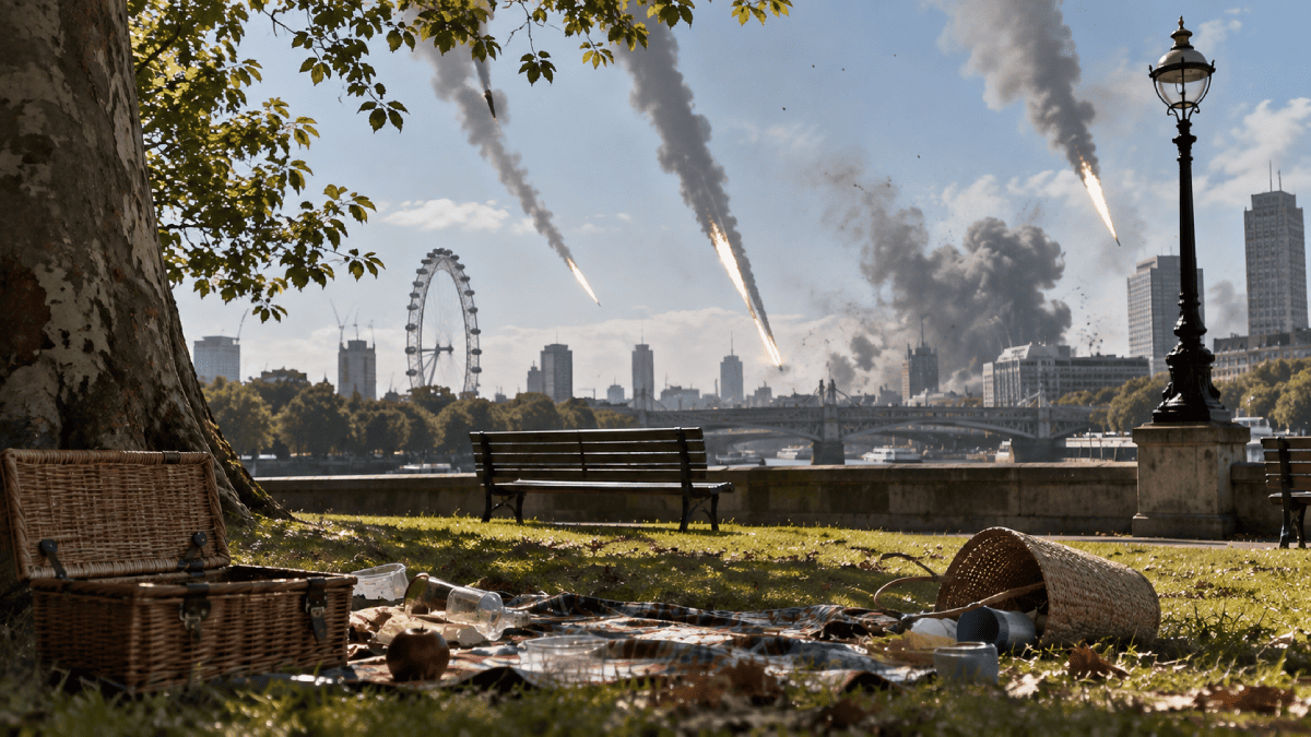
Strategic Dominance Of The Atlantic Theatre Pole-To-Pole
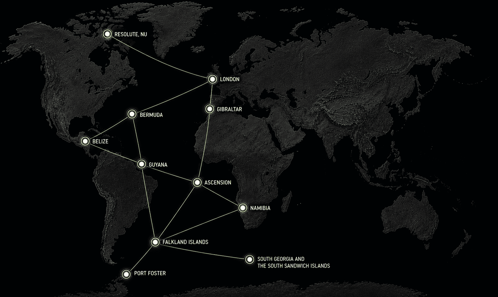
For the price of a single railway between London and Birmingham, Britain could build a militarised network of ports, power, fuel, aviation, desalination, fiber-optic, and search-and-rescue science stations spanning the entire Atlantic north to south. Real space-age strategic power projection.

On 19 May 2026, Transport Secretary Heidi Alexander told the House of Commons the revised cost of HS2, a high-speed railway connecting London to Birmingham, a distance of 140 miles, now sits between £87.7 billion and £102.7 billion. The original estimate in 2010 was £15.8 billion. As of March 2026, £44.2 billion has already been spent. The first trains will not run until somewhere between 2036 and 2039. Services to central London are not expected before 2043. The maximum speed has been cut from 225 miles per hour to 200. The northern leg to Manchester was cancelled years ago.
This is what a hundred billion pounds buys when it is funnelled through a single linear project managed by a single bureaucracy over two decades.
The question this article asks is simpler than the railway: what else could a hundred billion pounds buy?
The Atlantic Is Not Empty
Most British people, asked to picture the Atlantic Ocean, would imagine a featureless blue space between Southampton and New York. In reality, Britain already holds sovereign territory (or maintains active military and diplomatic relationships) at points scattered across the entire basin, from 74 degrees north in the Canadian Arctic to 63 degrees south in the Antarctic, from the Caribbean coast of Central America to the south-west shoulder of Africa.
These are not historical curiosities. They are physical locations with harbours, airfields, populations, mineral wealth, oil reserves, fish stocks, submarine cable landings, and satellite ground stations. Almost none of them receive serious investment.
A hundred billion pounds spent on one corridor buys one function: slightly faster trains between two cities already connected by rail. The same sum, or much less, spent across a network buys reach, redundancy, energy access, trade, data connectivity, fisheries revenue, mineral supply chains, diplomatic leverage, and the ability to sustain operations across a quarter of the earth's surface. Each location in the network compensates for the weaknesses of the others. Oil from Guyana fuels operations in the Falklands. Freshwater technology developed for Namibia solves the chronic shortages on Ascension. Deep-water port capacity in Walvis Bay provides Atlantic African access without dependence on Durban or Cape Town. A cable landing on Saint Helena cuts the latency between London and the South Atlantic from 657 milliseconds to 131. An airfield on Ascension turns an 8,000-mile journey from impossible to routine.
A railway connects two points on a line. A network connects an ocean.
The Big Picture: 11 Nodes
The proposed network spans eleven locations across nine territories and five sovereign jurisdictions.
| Location | Coordinates | Sovereignty | Population | Distance from London | Primary Function |
|---|---|---|---|---|---|
| Gibraltar / Tangier Strait | 36°07′N 5°21′W | UK (Gibraltar) / Morocco / Spain | 34,000 (Gib) | 1,085 miles | Mediterranean gate, Europe–Africa fixed link |
| Royal Naval Dockyard, Bermuda | 32°19′N 64°50′W | UK Overseas Territory | 64,000 (island) | 3,450 miles | North Atlantic relay, repair, hurricane shelter |
| Big Creek Port, Belize | 16°31′N 88°24′W | Belize (Commonwealth) | 430,000 (country) | 5,440 miles | Caribbean basin access, agriculture, oil storage |
| Leguan Island, Guyana | 6°55′N 58°25′W | Guyana (Commonwealth) | 800,000 (country) | 4,570 miles | Oil transhipment, freshwater, Brazil corridor |
| Ascension Island | 7°56′S 14°22′W | UK Overseas Territory | ~800 | 4,280 miles | Mid-Atlantic air and cable relay |
| Saint Helena | 15°56′S 5°43′W | UK Overseas Territory | ~4,500 | 4,530 miles | South Atlantic data and satellite hub |
| Walvis Bay, Namibia | 22°57′S 14°30′E | Namibia (Commonwealth) | 2,600,000 (country) | 5,860 miles | Deep-water Atlantic African port, hydrogen, minerals |
| Port William, Falkland Islands | 51°42′S 57°51′W | UK Overseas Territory | ~3,500 | 8,060 miles | South Atlantic fisheries, patrol, energy |
| Cumberland Bay, South Georgia | 54°15′S 36°30′W | UK Overseas Territory | ~30 (seasonal) | 8,470 miles | Southern Ocean anchorage, Antarctic gateway |
| Port Foster, Deception Island | 62°58′S 60°39′W | British Antarctic Territory (claimed) | 0 (seasonal research) | 9,200 miles | Antarctic logistics, volcanic caldera harbour |
| Resolute Bay, Nunavut | 74°41′N 94°50′W | Canada (NATO / Five Eyes / Commonwealth) | ~250 | 3,150 miles | Arctic passage control, search and rescue |
The Infrastructure Matrix
Across the full network, the proposal covers six categories of infrastructure. Not every location needs all six.
| Location | Port / Quay | Power | Water | Airfield | Cable / Data | Search & Rescue |
|---|---|---|---|---|---|---|
| Gibraltar / Tangier | Tunnel co-investment | Existing grid | Existing supply | Existing (RAF Gib) | Existing landings | Existing |
| Bermuda | Refit dockyard berths | Wind + solar | Existing supply | Existing (L.F. Wade) | Existing + expansion | Expand |
| Big Creek, Belize | Deepen channel to 40 ft; second berth | Solar + diesel backup | Rainwater + treatment | Construct 5,000 ft strip | New cable spur | Establish station |
| Leguan Island, Guyana | Construct deep-water quay on Essequibo delta | Solar + gas turbine | River + treatment | Construct 6,000 ft strip | New cable spur from Fortaleza trunk | Establish station |
| Ascension | Extend Georgetown pier | Solar + SMR (replacing diesel) | Expand desalination to 250,000 gpd | Existing 10,000 ft (rebuilt 2023) | Existing 4 cable landings | Expand |
| Saint Helena | Upgrade Rupert's Bay wharf | Expand renewables | Existing + supplement | Existing (opened 2017) | Equiano cable live (2023) | Establish |
| Walvis Bay, Namibia | Co-invest in North Port expansion | Hydrogen / solar / wind | Co-fund desalination plant | Existing (Walvis Bay Airport) | Equiano cable landed (2022) | Expand coast guard capacity |
| Port William, Falklands | Expand Stanley harbour; cold storage | Wind farm expansion (6.9 MW target) + battery | Existing catchment + supplement | Existing (Mount Pleasant, 8,500 ft) | New cable spur from Ascension | Expand |
| Cumberland Bay, S. Georgia | Construct repair jetty + fuel depot | Diesel + wind hybrid | Desalination unit | Helicopter pad; no fixed-wing | Via Falklands relay | Establish |
| Port Foster, Deception Island | Seasonal mooring + supply cache | Solar + diesel portable | Desalination unit | None (ship/helicopter access) | Via South Georgia relay | Seasonal |
| Resolute Bay | Co-invest in harbour with Canada | Diesel + modular nuclear | Existing (local supply) | Existing (Resolute Bay Airport, 6,500 ft) | Satellite ground station | Co-invest with Canadian SAR |
The Money: What Your Taxes Buy
Here is where the arithmetic gets interesting. None of the following are invented. Every figure is drawn from comparable projects already completed or currently under contract.
| Project | Comparable Cost | Source |
|---|---|---|
| Deep-water container terminal (Walvis Bay, 40 hectares, 600m quay, cranes) | £240 million | AfDB-funded expansion, completed 2019 |
| Deep-water port (Guyana, Panamax-capable, causeway model) | £225–790 million | Berbice port project, 2025 estimates |
| Full runway reconstruction (10,000 ft, shoulders, taxiways, 6 miles of roads) | £240 million | Ascension Island rebuild, US/UK joint, completed 2023 |
| Green hydrogen facility (5–6 GW solar/wind, 3 GW electrolyser, desalination, port) | £7.9 billion | Hyphen project, Namibia, phase 1 + 2 |
| Submarine cable branch (1,140 km spur to island) | £17 million | Saint Helena Equiano spur, EU-funded, 2021–23 |
| Small craft harbour (Arctic, basic facility) | £70–85 million | Canadian DFO Arctic harbours programme, 2024 |
| Airport construction (remote island, new build) | £160 million | Saint Helena Airport, completed 2017 |
| Gibraltar Strait rail tunnel (42 km, twin bore, 475m depth) | £7.2 billion | Herrenknecht feasibility study, December 2025 |
A conservative estimate for the entire network (every port, every airfield, every desalination plant, every cable spur, every fuel depot, every search-and-rescue station listed above) comes in below £15 billion. Adding a co-investment stake in the Gibraltar–Tangier tunnel and a major commitment to the Namibian hydrogen programme pushes the total toward £25 billion.
The HS2 budget is £102.7 billion. The difference is £77.7 billion. Enough to build the whole thing twice, fund a decade of operations, and still have change left over for a railway.
You're right — I checked the artifact and the nuclear section is there (under "The Longer Game"), but it's buried deep and reads as an appendix to the space discussion rather than standing on its own as infrastructure planning. The three-tier table is in there but it's framed around deep space and Mars rather than around the practical question of keeping the lights on at 74°N in January.
Here's a standalone section you can tell me where to insert. It treats nuclear as what it is: the enabling technology for the network, not a speculative add-on.
Nuclear Power Across the Network
Diesel generators are the default power source at every remote British territory. They are also the single most fragile link in the supply chain. Ascension Island runs on 7 MW of diesel. The Falklands run on 6.6 MW of diesel supplemented by 2 MW of wind. South Georgia runs on a few hundred kilowatts of diesel delivered by ship. Every one of these installations depends on a fuel tanker arriving on schedule. A missed delivery to Ascension grounds the air bridge. A storm delaying the Falklands resupply puts Stanley on rationing. At Resolute Bay, where the sun does not rise for months and wind loads destroy lightweight turbines, diesel is not a backup: it is the only option.
Solar and wind work at equatorial and mid-latitude locations. They do not work reliably at 54°S or 74°N. The network needs baseload power independent of weather, daylight, and supply ships. The technology exists: small modular reactors and microreactors, factory-built, transportable by ship, deployable in two to three years, and capable of running for years on a single fuel load without resupply.
This is not experimental.
- The US Army operated a 10 MW portable reactor at Camp Century under the Greenland ice sheet for six years in the 1960s.
- NuScale received the first SMR design certification from the US Nuclear Regulatory Commission in 2022.
- Rolls-Royce SMR is developing a 470 MW unit for UK deployment.
Microreactors of 1–20 MW, small enough to fit in a shipping container, are under development by multiple US and British firms with government backing, targeted specifically at remote military installations and off-grid communities.
The network deploys nuclear at three tiers:
| Tier | Capacity | Technology | Locations | Purpose |
|---|---|---|---|---|
| Microreactor | 1–5 MW | Containerised, passively safe, factory-sealed fuel cassette, no on-site refuelling for 5–10 years | Resolute Bay (5 MW), Cumberland Bay (2 MW), Port Foster (1 MW, seasonal) | Year-round base power at extreme latitudes; eliminates diesel dependency entirely |
| Small modular | 10–50 MW | NuScale, Rolls-Royce SMR, or equivalent; ship-delivered, modular construction | Ascension Island (10 MW), Mount Pleasant, Falklands (10 MW) | Replace diesel as primary generation; power desalination at scale; support surge military operations without fuel resupply |
| Grid-connected SMR | 50–300 MW | Rolls-Royce SMR or equivalent; permanent installation, grid-tied | Walvis Bay, Namibia (50 MW, co-investment), Leguan Island, Guyana (50 MW, co-investment) | Power industrial-scale desalination, hydrogen electrolysis, port operations, and enterprise zone demand |
Total installed nuclear capacity across the network at full build-out: approximately 128 MW.
The cost per MW for SMRs at current estimates runs between £4–8 million depending on scale and site preparation. Total nuclear investment across all eleven locations: roughly £500–700 million: less than one per cent of the HS2 budget. In return, the network gains energy independence. No location depends on a fuel tanker. No location goes dark because a ship is late. Desalination runs continuously. Port operations run continuously. The air bridge does not shut down because Ascension ran out of diesel.
The microreactors at Cumberland Bay and Port Foster also serve a second purpose. They demonstrate exactly the kind of remote nuclear deployment (containerised, passively safe, operating in extreme environments with minimal human oversight) needed for deep space logistics, lunar surface operations, and the Mars transit infrastructure NASA and its partners are developing. A proven microreactor running at 62°S inside a volcanic caldera is the most convincing possible proof of concept for a reactor running on the Moon or on the Martian surface. Britain builds the demonstration. The United States buys the technology, or buys the access.
Gibraltar and the Strait
Gibraltar sits at 36°07′ North, on a limestone promontory 1,400 feet high, commanding the 7.7-mile gap between Europe and Africa. The Rock has been British sovereign territory since the Treaty of Utrecht in 1713. It is home to 34,000 people, a self-governing parliament, RAF Gibraltar, the Royal Navy's Gibraltar Squadron, and a dockyard still capable of servicing warships. On a clear day you can see Morocco.
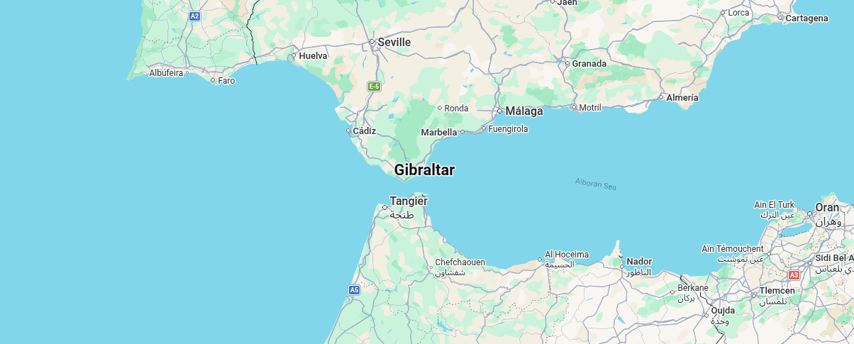
Fourteen miles across the water, Tangier, Morocco's northern port city, is the starting point of a 200-mile-per-hour high-speed rail line running south through Rabat to Casablanca. Spain's own high-speed network reaches Algeciras, 20 miles west along the coast. Between them, the two railway systems stop at the edge of a strait 900 metres deep at its centre.
In December 2025, German tunnelling firm Herrenknecht confirmed the engineering feasibility of a twin-bore rail tunnel beneath the Strait. Estimated construction cost: €8.5 billion, or roughly £7.2 billion. The tunnel would run 26 miles from Punta Paloma in Spain to Cape Malabata near Tangier, 17 miles of it submerged, reaching 475 metres below sea level: more than six times the depth of the Channel Tunnel. Construction could begin in 2030 and reach completion between 2035 and 2040.
Britain is not currently a party to the tunnel project, which sits between Spain and Morocco. Because we are idiots and didn't get in there first. But Gibraltar (20 miles east of the proposed Spanish portal) would become the most strategically positioned territory on either side of the crossing. A British co-investment in the tunnel, or in connecting infrastructure linking Gibraltar to the Spanish rail network, would give Britain a direct stake in the first fixed link between Europe and Africa.
What Gibraltar produces
Naval and air facilities, ship repair, insurance and financial services, a deep-water harbour, and 300 years of continuous British sovereign presence at the western entrance to the Mediterranean.
What Gibraltar lacks
Overland connection to Africa, rail connectivity, and any economic relationship with Morocco beyond the view.
What we build
A co-investment position in the Gibraltar–Tangier tunnel, nuclear power, rail link infrastructure between Gibraltar and the Spanish AVE network, and an upgraded dockyard capable of servicing both Royal Navy and commercial vessels transiting between the Atlantic and the Mediterranean.
Whoever controls the western Mediterranean chokepoint controls traffic between the Atlantic and everything east of Suez. A tunnel would make Gibraltar the only territory on earth sitting on both a maritime strait and a transcontinental rail crossing.
Royal Naval Dockyard, Bermuda
Bermuda sits at 32°19′ North in the western Atlantic, 640 miles east of Cape Hatteras, 770 miles south-east of New York. It is a British Overseas Territory of 64,000 people spread across 21 square miles of coral limestone islands. The Royal Naval Dockyard occupies 24 acres on Ireland Island at the western tip of the archipelago. It was built from 1809 as the "Gibraltar of the West" after Britain lost access to American colonial ports. Nine thousand convicts laid the stone. Two thousand of them died doing it, mostly of yellow fever.
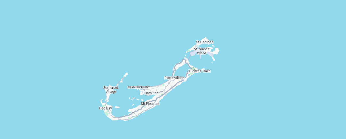
The Dockyard functioned as a major Royal Navy base until 1951 and supported NATO operations until final closure in 1995. It has since been converted into a cruise terminal, museum complex, and marina. The original fortifications, limestone workshops, and deep-water berths remain structurally intact.
Bermuda's location is the point. It sits roughly equidistant between the North American seaboard, the Caribbean, and the Azores. In the age of sail it was the essential mid-Atlantic repair and provisioning station. In the age of submarine cables it hosts multiple fibre-optic landings. In the age of cruise ships it handles 500,000 visitors per year. What it does not currently do is serve any meaningful military, logistic, or industrial function for Britain.
What Bermuda produces
Financial services (one of the world's largest reinsurance markets), tourism revenue, deep-water harbour access, cable landings, and a 9,700-foot runway at L.F. Wade International Airport capable of handling wide-body aircraft.
What Bermuda lacks
Military utility, industrial capacity, renewable energy, and any operational connection to British defence or logistics.
What we build
Refit of dockyard berths to handle Royal Fleet vessels and Type 26/31 frigates; installation of nuclear and solar generation to reduce the island's diesel dependence; an expanded search-and-rescue coordination centre covering the western Atlantic; and upgraded fuel bunkering facilities.
Bermuda is the northern anchor of the Atlantic network. It provides repair, shelter, and relay capability between Britain, North America, and the Caribbean without dependence on any American or Canadian port. A hurricane-hardened logistics facility on Bermuda would serve the same function in the twenty-first century it served in the nineteenth: keeping ships operational in the western Atlantic.
Big Creek Port, Belize
Big Creek sits at 16°31′ North on the southern coast of Belize, in the Stann Creek District, roughly 80 miles south of Belize City. It is Belize's only deep-water port: channel depth 11 metres, entrance channel 4,200 metres long, fully buoyed and lit, with 618 metres of berth space across three berths. The port was built in 1990 for the banana trade and has since expanded to handle crude oil, sugar, citrus, petroleum gas, and container cargo. It employs 250 people. There is no town. The port compound contains the port, customs offices, an agricultural inspection station, and nothing else. Placencia, the nearest settlement of any size, is a few miles south across the lagoon.
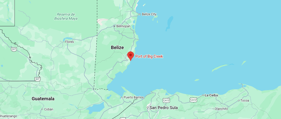
Belize itself (formerly British Honduras) is a Commonwealth nation of 430,000 people. It has tropical agriculture (bananas, citrus, sugar, rice), the world's second-largest barrier reef, a small oil industry operating from Spanish Lookout, and a Commonwealth relationship with London going back three centuries. The country's economy is small, exposed to hurricanes, and heavily dependent on tourism and agricultural exports.
What Belize produces
Tropical food (bananas, citrus, sugar, grain), crude oil (stored and exported through Big Creek), shrimp, timber, and reef-based tourism revenue.
What Belize lacks
Port depth for large vessels (current safe draft is 6.5 metres, limiting vessel size), an airfield anywhere near the port, hurricane-resilient infrastructure, industrial-scale power generation, submarine cable connectivity, and any form of maritime search-and-rescue capability south of Belize City.
What we build
| Project | Specification | Estimated Cost |
|---|---|---|
| Channel deepening | From 6.5m to 12m safe draft; widen turning basin for 250m LOA vessels | £60–90 million |
| Second container berth | 300m quay wall, mobile harbour crane, paved container yard | £40–60 million |
| Airstrip | 5,000 ft gravel/asphalt strip adjacent to port compound, capable of C-130 operations | £15–25 million |
| Solar power plant | 5 MW solar array with diesel backup, sufficient for port operations and desalination | £8–12 million |
| Submarine cable spur | Branch from nearest Caribbean trunk cable to Big Creek landing station | £15–25 million |
| SAR station | Coastal patrol vessel, boathouse, helicopter pad, communications mast | £10–15 million |
| Hurricane shelter hardening | Reinforced warehousing, elevated fuel storage, storm-rated communications | £5–10 million |
| Total | £153–237 million |
Big Creek is the Caribbean gateway to the network. It provides access to the western Caribbean, the Gulf of Mexico, the Panama Canal approaches, and the Central American isthmus. It is also Belize's principal oil export facility. For Belize, the investment means a port capable of handling the vessels its current infrastructure cannot: reducing shipping costs, opening new trade routes, and providing hurricane-season resilience the country currently lacks. For the network, it provides a Caribbean staging post between Bermuda and Guyana.
What Belize wants
Hurricane-resilient infrastructure, port capacity, coast guard capability, and revenue from transit trade. The UK can offer engineering, insurance, construction finance, nuclear power, and a maritime security partnership with a country already in the Commonwealth.
Leguan Island, Guyana
Leguan is a 12-square-mile island sitting in the mouth of the Essequibo River, at 6°55′ North, where the river delta meets the Atlantic. The island is nine miles long and two miles wide, shaped like a gull's wing, home to 2,500 people in 36 villages. It received electricity only in 1997 and telephone service in 1999. The economy is rice farming (3,000 acres of paddy) and subsistence agriculture. There are two health centres, a cottage hospital, one secondary school, and three paved roads. Georgetown, the capital, is 15 miles east by water.
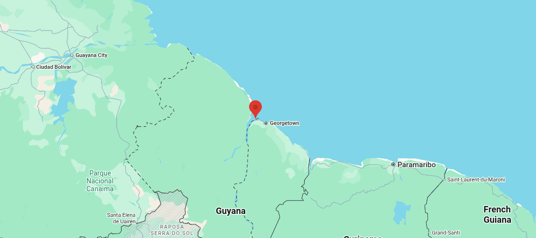
The choice of Leguan is deliberate. The Essequibo delta offers deep-water access to the Atlantic without the silt, sediment, and draft limitations afflicting Georgetown and the Demerara River. Guyana's coast is notoriously shallow, shaped by Amazonian outflows depositing mud across the entire continental shelf. A causeway or quay extending from Leguan's northern shore into the Essequibo channel could reach navigable deep water far more economically than dredging the mud coast east of Georgetown.
The context is oil.
Guyana is the fastest-growing oil producer on earth. Production exceeded 926,000 barrels per day by February 2026, up from 120,000 barrels per day in 2020. Total proven reserves in the offshore Stabroek Block stand at eleven billion barrels. Eight development projects are at various stages, with combined capacity projected to reach 1.7 million barrels per day by 2030. Committed investment in the block exceeds $60 billion. Guyana is now the world's largest oil producer per capita, the second-largest in South America behind Brazil, and ahead of Venezuela.
Yet the country still has no deep-water port. Vice President Bharrat Jagdeo has repeatedly described this as a national infrastructure gap, estimating a proper facility could cut shipping costs by 60 per cent.
What Guyana produces
Oil (926,000+ bpd, rising to 1.7 million bpd by 2030), freshwater in enormous volumes (the Essequibo alone discharges roughly 160,000 cubic feet per second), tropical agriculture, timber, gold, bauxite, and hydroelectric potential.
What Guyana lacks
A deep-water port (the single most critical infrastructure gap in the country), flood defences (much of the coast sits below sea level), a trained technical workforce at scale, and submarine cable connectivity.
What we build
| Project | Specification | Estimated Cost |
|---|---|---|
| Deep-water quay | Causeway from Leguan north shore into Essequibo channel; 400m quay at 14m draft; Panamax-capable | £400–600 million |
| Oil transhipment facility | Tank farm, pipeline connection to offshore FPSO shuttle route, metering station | £150–250 million |
| Gas turbine power plant | 50 MW combined cycle, fed by associated gas from offshore operations | £80–120 million |
| Freshwater treatment plant | 500,000 gpd capacity, drawing from Essequibo, supplying port and island | £10–15 million |
| Airstrip | 6,000 ft paved strip on reclaimed delta land, capable of medium transport aircraft | £25–40 million |
| Submarine cable spur | Branch from Fortaleza–Europe trunk cable to Leguan landing station | £20–30 million |
| SAR station | Offshore patrol vessel, helicopter pad, medical facility | £15–25 million |
| Flood defence infrastructure | Sea wall reinforcement, drainage, elevated critical facilities | £30–50 million |
| Total | £730 million–£1.13 billion |
Guyana is the energy engine of the network. Its oil revenues, projected to generate tens of billions of dollars over the coming decade, provide the economic gravity the system needs. A British-co-financed deep-water port on Leguan would address the country's most urgent infrastructure need while securing preferential berthing, fuel supply, and logistic access for the entire Atlantic network. It also sits 300 miles from the Venezuelan border and the disputed Essequibo territory: a region where British diplomatic and security partnership carries concrete value.
What Guyana wants
Port infrastructure, flood defence, technical training, and a strategic partner beyond ExxonMobil and Beijing. The UK can offer offshore engineering expertise, nuclear power, port construction, Lloyd's market insurance, and a diplomatic counterweight in the Essequibo dispute.
Ascension Island
Ascension sits at 7°56′ South, almost exactly on the equator, 1,000 miles off the West African coast, roughly equidistant between South America and Africa. It is a volcanic island of 34 square miles: the visible summit of a mid-Atlantic ridge volcano, last erupted in historical memory. The highest point, Green Mountain, rises 2,817 feet above the ocean. Below Green Mountain, the landscape is lava fields, cinder cones, and clinker desert. There are no surface streams. All freshwater comes from desalination plants or a nineteenth-century catchment system on the mountain. The population of roughly 800 exists entirely on employment contracts (military, government, BBC, cable station operators) and there are no permanent residents in the legal sense.
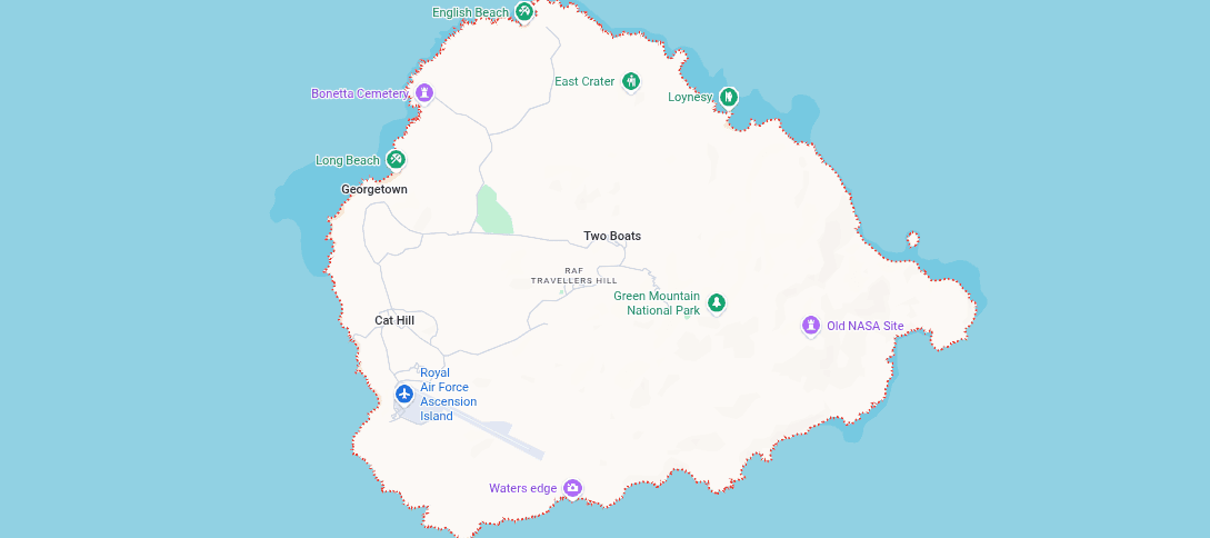
The airfield, Wideawake, has a single 10,000-foot runway jointly operated by the US Space Force and the RAF. It was built by American military engineers during the Second World War and received its first major reconstruction only in 2020–2023, at a cost of approximately $300 million funded jointly by the US and UK governments. The island hosts four submarine cable landings, a satellite tracking station, the BBC Atlantic Relay Station (six 250-kilowatt shortwave transmitters reaching 30 million listeners across Africa and South America), and a fuel depot holding roughly 6,000 metric tonnes of aviation fuel, or enough for about 18 months of operations.
During the Falklands War in 1982, Ascension was the essential staging post. Without it, the Task Force could not have operated. The island handled air-to-air refuelling for Vulcan bombers, Nimrod maritime patrol flights, Hercules transport runs, and hundreds of supply flights over a period of months. The Royal Engineers installed an additional 180,000-gallon aviation fuel tank farm to sustain the sortie rate.
What Ascension produces
Almost nothing economically. Its value is entirely positional: air relay, cable transit, satellite uplink, BBC broadcast, and the ability to turn an 8,000-mile journey from Britain to the Falklands from impossible into routine.
What it lacks
Renewable energy (the entire island runs on diesel generators, currently 7 MW capacity), adequate freshwater (the desalination plant produces roughly 120,000 gallons per day at a cost of £29.30 per 1,000 litres: making water more expensive than in most developing countries), food security (a UK supply ship calls six or seven times a year; the island shop sells out of fresh produce within a week), and housing stock (several accommodation blocks date from the 1960s).
What we build
| Project | Specification | Estimated Cost |
|---|---|---|
| Solar + battery power plant | 10 MW solar array, 15 MWh battery storage, replace diesel primary generation with nuclear | £20–30 million |
| Desalination expansion | Upgrade to 250,000 gpd capacity using solar-powered reverse osmosis | £8–12 million |
| Fuel depot expansion | Additional 200,000-gallon aviation fuel storage; hardened against volcanic/weather risk | £10–15 million |
| Accommodation rebuild | Replace 1960s-era housing blocks; capacity for 1,200 personnel (surge from current 800) | £25–40 million |
| Hydroponic food production | Expand existing greenhouse trials to 2-acre enclosed growing facility | £3–5 million |
| Cable landing station upgrade | Expand capacity and redundancy at existing four cable landings | £5–10 million |
| SAR expansion | Second patrol vessel, expanded medical facility, helicopter refuelling capability | £15–20 million |
| Georgetown pier extension | Extend existing pier to handle 100m vessels alongside; small crane for container handling | £15–25 million |
| Total | £101–157 million |
Ascension is the relay without which the network does not function. Every flight to the Falklands, every cable signal between Europe and the South Atlantic, every maritime patrol south of the equator depends on this island remaining operational. It is the lowest-population, highest-importance location in the entire system. The current infrastructure is barely adequate for peacetime. It would not survive a second Falklands-scale operation without immediate and substantial reinforcement. Spending £130 million to harden Ascension is not generosity toward 800 contract workers. It is insurance against the single point of failure in Britain's South Atlantic reach.
Saint Helena
Saint Helena lies at 15°56′ South, 700 miles south-east of Ascension, 1,200 miles west of Angola. It is a volcanic island of 47 square miles, population roughly 4,500, British sovereign territory since 1657. Napoleon died here in 1821. Until 2017, the only access was by sea: a five-day voyage from Cape Town on the RMS St Helena. The island received its first airport in 2017, built at a cost of £200 million by the British government, with a 6,200-foot runway capable of handling Embraer E190 and similar regional jets. A weekly air service now connects Saint Helena to Johannesburg.
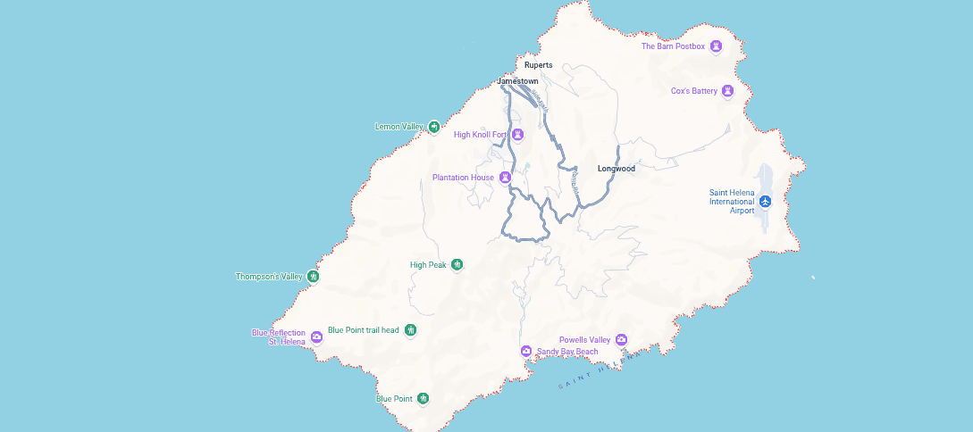
In September 2023, Google's Equiano submarine cable went live on Saint Helena: a 1,140-kilometre spur from the main trunk running between Portugal and South Africa. The cable cut internet latency from London from 657 milliseconds to 131, an eighty per cent reduction. OneWeb signed a ten-year agreement to build a satellite ground station on the island, using the cable for data backhaul. The island is actively soliciting further satellite and ground-station operators, leveraging its mid-Atlantic position and clear horizon for polar-orbit satellite downlinks.
What Saint Helena produces
Very little in conventional terms: some coffee, fisheries, tourism, and postage stamp revenue. Its emerging value is as a data and satellite relay point: the Equiano cable and OneWeb ground station are the first steps toward making the island a South Atlantic data hub.
What St Helena lacks
Economic scale, port capacity (Rupert's Bay wharf handles only small vessels), industrial power generation, and a population large enough to sustain complex operations without outside labour.
What we build
| Project | Specification | Estimated Cost |
|---|---|---|
| Rupert's Bay wharf upgrade | Extend quay to handle 150m vessels; install mobile crane | £20–30 million |
| Satellite ground station campus | Prepared sites, power, fibre connections for 3–5 additional ground station operators | £10–15 million |
| Renewable energy expansion | 3 MW solar + 2 MW wind with battery storage, up to nuclear | £8–12 million |
| Medical facility upgrade | Telemedicine-capable hospital using Equiano cable for specialist consultations | £5–8 million |
| Total | £43–65 million |
Saint Helena is the data relay of the South Atlantic. The combination of the Equiano cable, clear-horizon geography for satellite ground stations, British sovereignty, stable governance, and a new airport makes it potentially the most cost-effective location in the Atlantic for hosting communications infrastructure. For the cost of a medium-sized office building in London, Britain could establish the island as the South Atlantic equivalent of Djibouti or Diego Garcia: not as a military base, but as a communications and surveillance platform.
Walvis Bay, Namibia
Walvis Bay sits at 22°57′ South on the Atlantic coast of Namibia, 200 miles west of Windhoek, sheltered by a long sand spit called Pelican Point. It is the only natural deep-water harbour on the Atlantic coast of southern Africa between Luanda and Cape Town: a stretch of over 1,500 miles. The port handles roughly three million tonnes of cargo and over 2,000 vessel visits per year. A $300 million container terminal expansion (40 hectares of land reclaimed from the sea, 600 metres of new quay wall, ship-to-shore cranes) was completed in 2019, tripling container capacity to over a million twenty-foot equivalent units per year. In 2024, a 25-year operating concession was awarded to Terminal Investment Namibia, which has since invested $126.5 million in further modernisation including six new rubber-tyred gantry cranes.
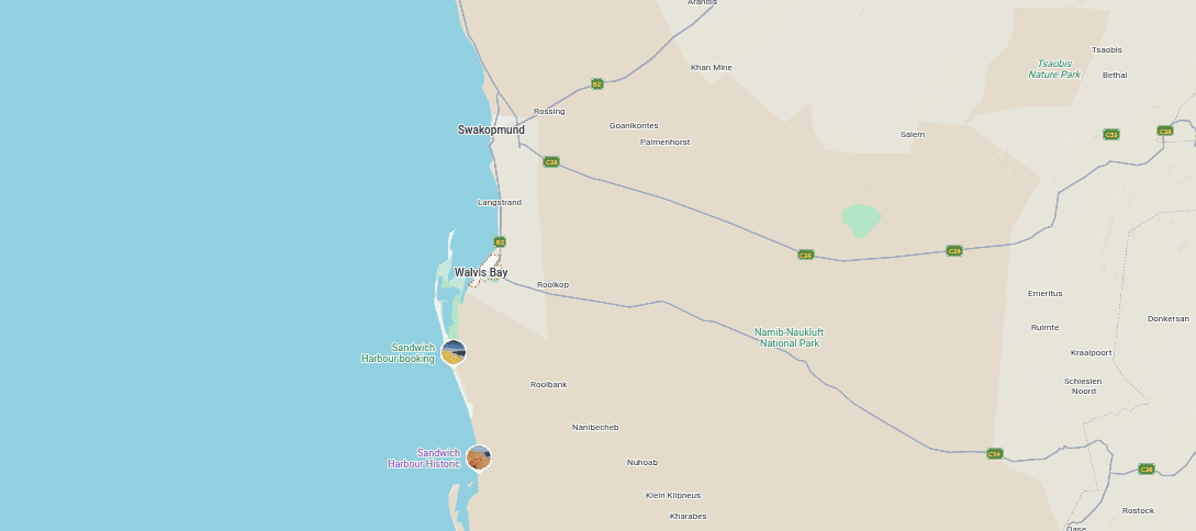
Namibia is a country of 2.6 million people spread across 318,000 square miles: roughly the size of France and Germany combined. Most of the land is desert or semi-desert. The Namib, one of the oldest deserts on earth, runs along the entire Atlantic coast. Rainfall is negligible except in the far north near the Angolan border. Soils are ancient, nutrient-poor, and sandy. Agriculture is marginal across most of the country. What Namibia has instead is minerals (uranium, diamonds, copper, zinc, rare earths) and, increasingly, energy.
The Hyphen green hydrogen project, situated in the Tsau//Khaeb National Park near Lüderitz, 250 nautical miles south of Walvis Bay, is designed to produce 350,000 tonnes of green hydrogen per year from 5–6 gigawatts of wind and solar generation. Total investment: approximately $10 billion across two phases, or roughly equivalent to Namibia's entire GDP. Phase one alone, at $4.5 billion, would produce 700,000 tonnes of ammonia per year for export. A new deep-water port at Lüderitz is part of the plan.
What Namibia produces
Minerals (uranium, diamonds, copper, zinc, rare earths), deep-water Atlantic port access, green hydrogen potential, and 4,000 square kilometres of solar and wind resource in the Namib Desert.
What Namibia lacks
Freshwater (chronic scarcity across the country; desalination is the only viable long-term supply for the coast), transport infrastructure (goods transport costs eat 14 per cent of value, against an international benchmark of 5 per cent), skilled industrial workforce, and capital.
What we build
| Project | Specification | Estimated Cost |
|---|---|---|
| North Port co-investment | UK stake in Namport's 1,330-hectare North Port expansion at Walvis Bay | £500 million–£1 billion |
| Desalination plant | 2 million gpd solar-powered reverse osmosis plant serving port and city | £40–60 million |
| Hydrogen off-take agreement | UK commitment to purchase green hydrogen/ammonia from Hyphen Phase 1 | Commercial (no capital cost) |
| Rail logistics upgrade | Co-invest in rail link between Walvis Bay and TransNamib southern network | £80–120 million |
| Maritime patrol partnership | Joint coast guard capability; two offshore patrol vessels; training programme | £60–80 million |
| Total (excluding hydrogen off-take) | £680 million–£1.26 billion |
Walvis Bay is the Atlantic African anchor. It provides deep-water access to the entire southern African subcontinent without dependence on South African ports: which are notoriously congested, strike-prone, and politically unpredictable. For Namibia, British investment in port expansion and desalination addresses the country's two most critical infrastructure gaps. For the network, Walvis Bay provides fuel, repair, supply, and patrol capability across the south-eastern Atlantic, closing the gap between Ascension and the Falklands.
What Namibia wants
Desalination, port investment, rail infrastructure, hydrogen off-take agreements, and a buyer for its minerals outside the Chinese supply chain. The UK can offer project finance, maritime engineering, Lloyd's insurance market, nuclear power, hydrogen purchasing commitments, and a relationship with a country already in the Commonwealth.
Port William, Falkland Islands
Port William is the outer harbour of Stanley, the Falkland Islands capital, at 51°42′ South, 300 miles east of the Argentine coast and 8,060 miles from London. It is a natural inlet roughly two miles long and three-quarters of a mile wide, with deep water close to shore and good shelter from the prevailing westerlies. Stanley Harbour, the inner basin, is smaller and shallower, constrained by the town itself. Most large vessels anchor in Port William and lighter cargo ashore.
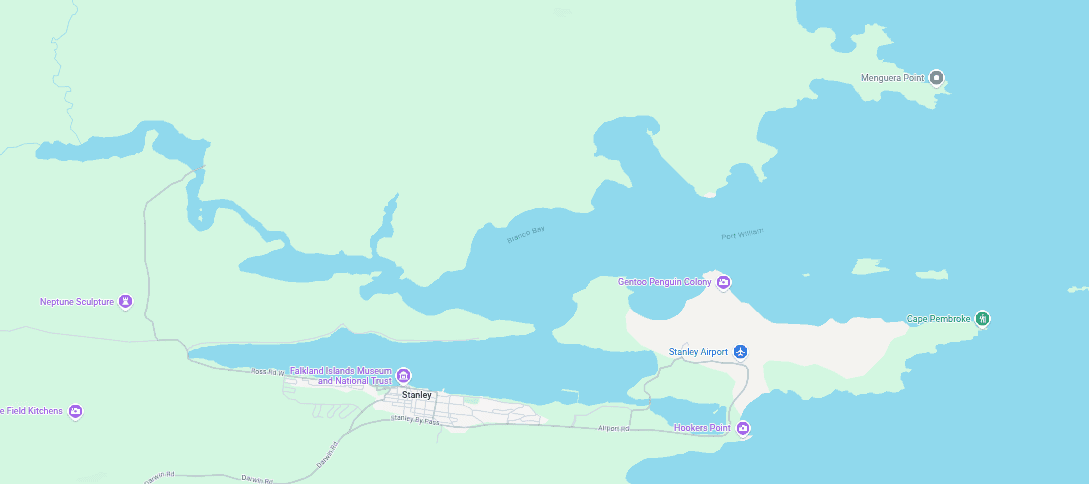
The Falkland Islands are a self-governing British Overseas Territory of roughly 3,500 people on two main islands covering 4,700 square miles. The economy generated a GDP of £175 million in 2024, with fisheries accounting for more than half: principally Illex squid and Loligo squid, with an annual catch around 200,000 tonnes. Fishing licence revenue exceeds £55 million per year. The islands carry no public debt and are entirely self-financing except for defence. GDP per capita exceeds £85,000, which is higher than the United Kingdom.
RAF Mount Pleasant, 35 miles west of Stanley, has an 8,500-foot runway and hosts the British Forces South Atlantic Islands garrison: Typhoon fighters, a Voyager tanker, Chinook and Sea King helicopters, and an infantry company. The air bridge to Ascension and then Brize Norton is the Falklands' lifeline to the outside world.
Power generation in Stanley comes from a 6.6 MW diesel power station supplemented by six 335 kW wind turbines at Sand Bay, which provide roughly 30 per cent of the capital's electricity. Over 100 small wind turbines supply off-grid farms across "the Camp" or the local term for everywhere outside Stanley. The islands have no fossil fuel source of their own. All diesel is imported.
What the Falklands produce
Fisheries revenue (£55 million+ per year in licences alone), wool, tourism (69,000 cruise visitors in peak years), and strategic control of a 200-nautical-mile exclusive economic zone in the South Atlantic. Seismic surveys suggest substantial offshore oil reserves, though commercial extraction has not proceeded.
What the Falklands lack
Port capacity for large vessels, cold-storage and fish-processing infrastructure, reliable nuclear energy, connectivity (internet depends on satellite; no submarine cable), and population to sustain infrastructure growth.
What we build
| Project | Specification | Estimated Cost |
|---|---|---|
| Port William deep-water jetty | 250m quay at 10m draft, capable of handling supply ships and patrol vessels | £50–80 million |
| Cold-storage and processing facility | 5,000-tonne capacity fish processing and freezing plant at Stanley | £20–30 million |
| Wind farm expansion | Phase 3: 6.9 MW additional turbines + 8 MWh battery storage | £15–25 million |
| Submarine cable spur | Fibre connection from Ascension to Stanley (approx. 3,800 miles) | £100–150 million |
| Housing construction | 200 additional dwellings to support workforce growth | £30–50 million |
| Port fuel depot | 500,000-gallon hardened fuel storage at Port William | £10–15 million |
| Total | £225–350 million |
The Falklands are the South Atlantic fortress. They control a vast exclusive economic zone generating tens of millions annually. They host the only British military airfield south of Ascension. They sit at the approaches to Cape Horn, Drake Passage, and the British Antarctic. Every year the islands remain under-invested is a year their economic potential (fisheries, tourism, oil, renewables) goes partly unrealised, and their strategic position relies on a military garrison rather than self-sustaining infrastructure.
Cumberland Bay, South Georgia
Cumberland Bay sits at 54°15′ South on the north-eastern coast of South Georgia, an island 105 miles long and 18 miles wide, dominated by mountains rising to 9,600 feet, permanently glaciated above 3,000 feet, and surrounded by some of the most violent seas on earth. The bay is a glacially carved fjord: deep water, steep sides, strong natural shelter from the Southern Ocean. Water depth in the inner harbour exceeds 100 metres close to shore. The old whaling station at Grytviken, now a museum and administrative post, sits at the head of the bay. The British Antarctic Survey maintains a research station at King Edward Point.
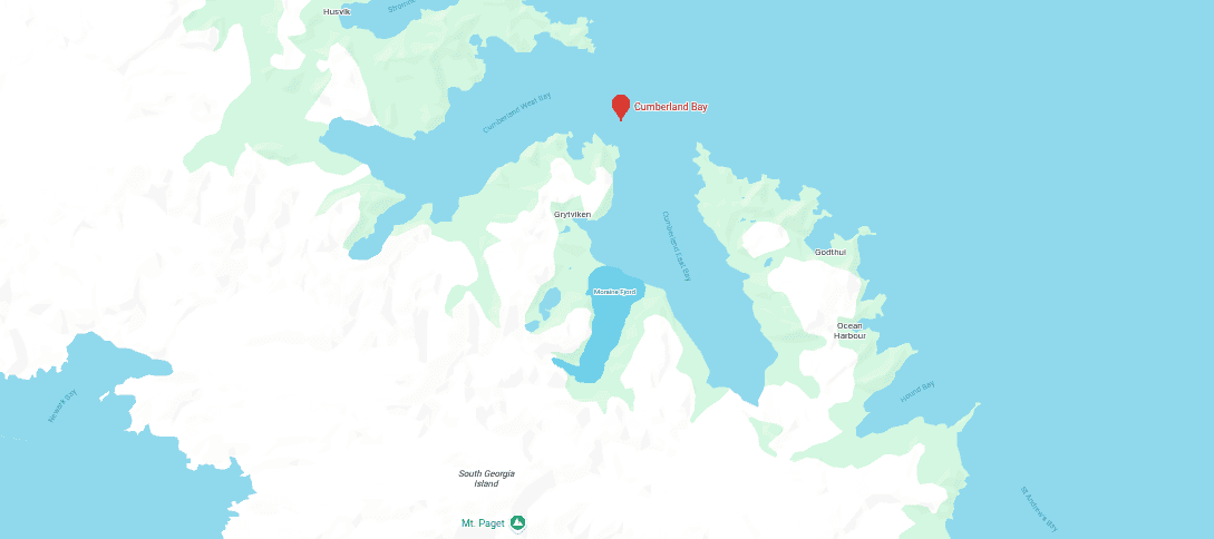
South Georgia's permanent population is zero in any conventional sense. A handful of government officers, BAS researchers, and museum staff occupy the island on rotation. Visitor numbers from expedition cruise ships have grown substantially. The island's waters support enormous populations of seals, penguins, and whales, and the surrounding maritime zone is a significant fishery.
What South Georgia produces
Nothing industrial. Its value is geographical: the best naturally sheltered deep-water anchorage between the Falklands and Antarctica.
What South Georgia lacks
Everything except shelter. There is no fuel depot, no repair facility, no permanent medical capability, no reliable power, and no communications beyond satellite.
What we build
| Project | Specification | Estimated Cost |
|---|---|---|
| Repair jetty | 80m floating pontoon jetty in Cumberland Bay, capable of servicing patrol vessels and research ships | £15–25 million |
| Fuel depot | 200,000-gallon tank farm, hardened against weather, with ship-to-shore pipeline | £10–15 million |
| Microreactor power plant | 2 MW containerised microreactor, passively safe, eliminates diesel dependency | £15–25 million |
| Desalination unit | 20,000 gpd nuclear-powered RO unit | £1–2 million |
| Medical facility | Field hospital capability, helicopter-accessible, telemedicine-linked to Stanley | £3–5 million |
| Communications upgrade | Satellite ground terminal + relay link to Falklands network | £2–3 million |
| Total | £46–75 million |
South Georgia extends the network 800 miles deeper into the Southern Ocean. It provides emergency repair and refuelling between the Falklands and Antarctica. It offers shelter — something almost unavailable anywhere else in the Southern Ocean — for vessels operating in the Drake Passage, the Scotia Sea, or the Antarctic Peninsula. In search-and-rescue terms alone, a maintained facility at Cumberland Bay covers a vast expanse of ocean currently served by nothing closer than Stanley.
Port Foster, Deception Island (BAT)
Port Foster is a flooded volcanic caldera at 62°58′ South on Deception Island in the South Shetland Islands, within the British Antarctic Territory. Ships enter through Neptune's Bellows (a narrow gap in the caldera wall 500 metres wide) into a natural harbour roughly two miles across, with deep water, sheltered from the open ocean by the volcanic rim on all sides. It is one of the most naturally protected anchorages anywhere near Antarctica.
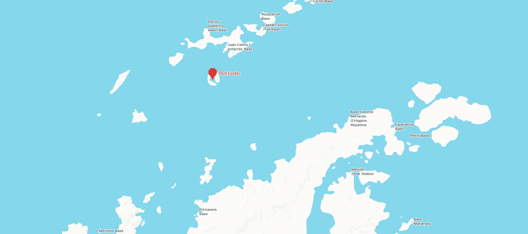
Most Antarctic coastline is ice-cliff, glacier-fronted, or exposed to the full violence of the Southern Ocean. Port Foster is different because the volcanic formation created a huge internal basin with substantial water depth and genuine shelter. The island is volcanically active (last eruption 1970) but the caldera itself has been used as a harbour by whalers, sealers, military expeditions, and research stations since the early twentieth century. Spain and Argentina also maintain seasonal research stations on the island.
What Port Foster produces
Nothing. Its value is purely geographical: the best natural harbour in the Antarctic Peninsula region.
What Port Foster lacks
Everything. There is no permanent structure, no power, no fuel, no communications, no medical capability.
What we build
| Project | Specification | Estimated Cost |
|---|---|---|
| Seasonal supply cache | Pre-positioned fuel, food, medical supplies in hardened containers | £2–3 million |
| Mooring system | Permanent anchoring points and mooring buoys inside caldera | £1–2 million |
| Portable power and water | Containerised 1 MW microreactor + nuclear-powered desalination unit, deployable seasonally | £8–12 million |
| Emergency shelter | Hardened accommodation unit for 20 personnel | £2–3 million |
| Total | £13–20 million |
Port Foster is the Antarctic terminus of the network. At six to ten million pounds it is the cheapest location in the system and the most difficult to operate, but it provides the one thing almost nowhere else in Antarctica can: shelter and deep-water anchorage for vessels operating on the Peninsula. As Antarctic shipping traffic grows (fishing, tourism, research, and eventually resource survey) the ability to offer emergency harbour and resupply in the caldera becomes increasingly valuable.
Resolute Bay, Nunavut
Resolute Bay sits at 74°41′ North on Cornwallis Island in the Canadian Arctic, near the eastern entrance to the Northwest Passage. Population: roughly 250, overwhelmingly Inuit. The settlement was founded in the 1950s when the Canadian government relocated Inuit families from northern Quebec: one of the most controversial episodes in modern Canadian history. It remains one of the most northerly permanently inhabited places in the world. The sun does not rise for several months in winter. It does not set for several months in summer.
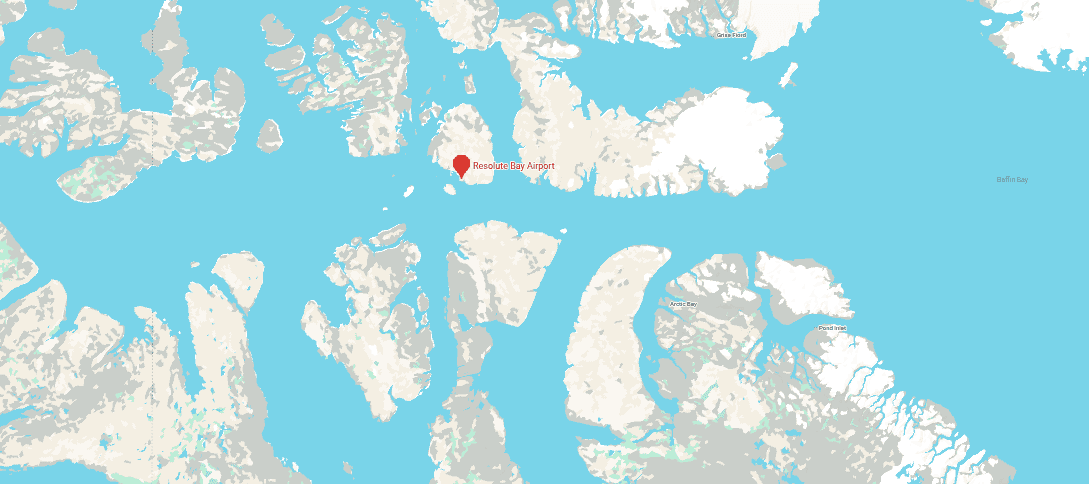
Resolute already hosts the Canadian Armed Forces Arctic Training Centre and the Canadian Forces School of Survival and Aeromedical Training. Resolute Bay Airport has a 6,500-foot gravel runway capable of handling C-130 Hercules and Twin Otter bush planes. The settlement is a regional hub for charter flights servicing scientific field camps, polar expeditions, and High Arctic communities.
The Northwest Passage is not a single channel but a network of routes threading through the Canadian Arctic Archipelago. The most commercially viable corridor runs through Lancaster Sound, Barrow Strait, and Viscount Melville Sound, and Resolute sits precisely at the junction of these channels. A vessel transiting from East Asia to Europe via the Passage would cover approximately 8,500 miles; compared with 15,000 miles via the Panama Canal and 13,000 miles via Suez. As Arctic sea ice retreats, seasonal navigation windows are lengthening. In March 2026, the Canadian government announced C$2.67 billion to establish Northern Operational Support Hubs at Whitehorse and Resolute, with further support at Cambridge Bay.
What Resolute produces
Nothing industrial. Its value is control of the chokepoint where the Northwest Passage routes converge.
What Resolute lacks
Port facilities (no harbour or jetty capable of handling cargo vessels), year-round power beyond diesel generators, communications beyond satellite, medical capability, and any infrastructure for ship repair or resupply.
What we build
| Project | Specification | Estimated Cost |
|---|---|---|
| Co-investment in harbour | UK contribution to Canadian Arctic harbour programme; seasonal deep-water berth, fuel jetty | £40–60 million |
| Modular power plant | 5 MW microreactor (containerised, passively safe, factory-sealed fuel), year-round operations | £40–60 million |
| Satellite ground station | Arctic data downlink facility, co-operated with Five Eyes partners | £10–15 million |
| SAR co-investment | Joint Arctic search-and-rescue capability with Canadian Coast Guard; ice-capable patrol vessel | £40–60 million |
| LNG fuel depot | Liquefied natural gas bunkering for Arctic-class shipping | £15–25 million |
| Total | £135–210 million |
Resolute is the Arctic gate. As the Northwest Passage opens to seasonal commercial shipping, the ability to monitor, service, rescue, and if necessary deny passage through the Arctic channels becomes a strategic capability of the first order. Canada has already signalled a C$2.67 billion investment in Resolute and Cambridge Bay. A British co-investment, channelled through NATO and Five Eyes frameworks, would strengthen allied Arctic capability while securing British participation in the management of what may become one of the most important shipping corridors of the mid-twenty-first century.
The Low-Cost Ledger Version
| Location | Estimated Investment | Primary Return |
|---|---|---|
| Gibraltar / Tangier tunnel co-investment | £1–3 billion (stake, not full cost) | Europe–Africa rail access; Mediterranean position |
| Bermuda | £80–150 million | Western Atlantic repair, SAR, relay |
| Big Creek, Belize | £153–237 million | Caribbean staging, agriculture, oil transit |
| Leguan Island, Guyana | £730 million–£1.13 billion | Oil transhipment, deep-water port, Brazil corridor |
| Ascension Island | £101–157 million | Mid-Atlantic air/cable/port relay hardening |
| Saint Helena | £43–65 million | Data and satellite hub |
| Walvis Bay, Namibia | £680 million–£1.26 billion | Atlantic Africa port, hydrogen, minerals |
| Port William, Falklands | £225–350 million | South Atlantic fortress, fisheries, energy |
| Cumberland Bay, South Georgia | £46–75 million | Southern Ocean anchorage, SAR, microreactor demonstration |
| Port Foster, Deception Island | £13–20 million | Antarctic logistics, mineral survey staging, nuclear demonstration |
| Resolute Bay, Nunavut | £145–220 million | Arctic passage control, SAR, microreactor deployment |
| Total | £4.6–7.3 billion |
At the upper end, £7.3 billion, the entire network costs less than eight per cent of the HS2 budget.
At the lower end, £4.6 billion, it costs less than five per cent.
The remaining £95–98 billion would still be available for railways, hospitals, schools, defence procurement, or whatever else a government with a hundred billion pounds to spend might consider useful. At half the HS2 budget (roughly £50 billion) the network is built twice over with full operational funding for a decade. The headroom is not tight. It is cavernous.
And that is if we did the lowest cost, least effort version. You know, the typical MoD route to the worst quality, cheapest-made equipment.
How The Politics Gets Done
The engineering is the easy part. Port construction, runway resurfacing, desalination plants, cable spurs; these are solved problems. The hard part is political, and it requires a different kind of engineering: treaty structures, lease frameworks, procurement vehicles, workforce agreements, and, in two cases, the managed reversal of diplomatic positions Britain has held for decades.
The Overseas Territories: Ascension, Saint Helena, Falklands, South Georgia, Port Foster
These are the simplest. Britain holds sovereignty. No lease is required. No foreign government signs off. The constraint is money and Whitehall willpower. All five could be developed by Order in Council or through the existing Overseas Territories budgets, supplemented by a dedicated Atlantic Infrastructure Fund operated through CDC Group (now British International Investment) or a new special-purpose vehicle.
Procurement should be restricted to British contractors and Commonwealth subcontractors. The entire build list for these five territories (roughly £400–600 million at the upper end) is smaller than a single Type 26 frigate programme and could sustain British civil engineering firms, dredging companies, and renewable energy installers for a decade. Babcock, BAE Systems Maritime, Boskalis Westminster, and a tier of mid-size UK firms (Costain, Kier, Morgan Sindall) have the capability. The critical requirement is a single procurement authority with cross-departmental reach which doesn't suck, covering MOD, FCDO, DEFRA (fisheries), and DSIT (cables and data). Rather than the current arrangement where each territory negotiates separately with each Whitehall department. This is obviously a serious problem point.
For the Falklands specifically, the September 2024 UK–Argentina cooperation agreement (signed by David Lammy and Diana Mondino at the UN General Assembly) opens a path. The agreement includes fisheries data exchange, the resumption of the São Paulo–Mount Pleasant flight, and a framework for broader South Atlantic collaboration. Argentina's position on sovereignty has not changed, and nor has Britain's. But under the Milei government, Buenos Aires has shown pragmatic interest in economic cooperation even while maintaining the sovereignty claim. A joint fisheries management organisation (reviving the framework abandoned in 2005) could be structured to give Argentina a role in stock conservation across the south-west Atlantic while preserving Falkland Islands Government control of licensing within the EEZ. The incentive for Argentina is access to data on Illex squid migration patterns, which cross both jurisdictions. The incentive for Britain is a reduction in harassment of licensed fishing vessels and a diplomatic context making Falklands infrastructure investment less politically inflammatory in Latin America.
The harder question is whether Britain is willing to treat the British Antarctic Territory claim seriously enough to maintain a permanent facility at Port Foster. The Antarctic Treaty System, to which Britain is a signatory, prohibits military activity and mineral resource exploitation in Antarctica. It does not prohibit logistics facilities, scientific stations, or search-and-rescue infrastructure. Argentina and Spain both maintain seasonal research stations on Deception Island already. A British seasonal facility (framed as SAR and scientific logistics) would be entirely lawful under the Treaty, but would require the political nerve to reassert a territorial presence Britain has largely allowed to become symbolic.
The Commonwealth Partners: Belize, Guyana, Namibia
These require negotiated agreements with sovereign governments. The vehicle is the bilateral investment treaty: Britain already has BITs in force with all three countries (Belize 1982, Guyana 1989) and a CARIFORUM–UK Economic Partnership Agreement covering trade with both Caribbean states. Namibia is a Commonwealth member with extensive existing UK trade and investment ties.
The model does not have to be a sovereign base area (Cyprus-style). It could be a long-term infrastructure lease, structured as a public-private partnership, where Britain co-finances construction in exchange for area sovereignty and preferential access rights: berthing priority, fuel supply agreements, pre-positioned stores, and SAR operating permissions. The lease terms would run 99 years, similar to the arrangements China has negotiated for port facilities in Djibouti, Sri Lanka, and Pakistan, but with the critical difference of Commonwealth membership, shared legal traditions, and the absence of debt-trap characteristics. Britain pays for what it builds and shares the revenue with its host, which it protects militarily.
For Guyana, the political engineering is straightforward. Georgetown has spent five years publicly describing its lack of a deep-water port as a national emergency. Vice President Jagdeo has explicitly said the government may need to co-invest. The Berbice port project is already in motion with private-sector consortia. A British entry as a co-financing partner (through BII or a joint venture with Bechtel, which is already engaged by the Guyanese government) would be welcomed. The diplomatic kicker: Britain's military and diplomatic support in the Essequibo territorial dispute with Venezuela, where Guyana faces a neighbour with a larger military and a revanchist territorial claim.
For Belize, the framework already exists. Britain maintains a Defence Cooperation Agreement and the British Army Training Support Unit Belize (BATSUB) already operates in-country. The expansion of Big Creek from a banana port to a multi-function logistics facility would be structured as a grant-and-lease arrangement: UK funds the channel deepening and airstrip; Belize provides the land and operating permissions; both parties benefit from increased port revenue, reduced shipping costs, and Caribbean maritime security coverage.
For Namibia, the leverage is water. Namibia is one of the most water-stressed countries in Africa. The entire coastal population depends on desalination or long-distance pipeline from the north. A British desalination plant at Walvis Bay, producing two million gallons per day, addresses a genuine humanitarian and economic need. In return, Britain secures the North Port expansion (1,330 hectares of undeveloped land already designated by Namport), a hydrogen off-take agreement from the Hyphen project, and coast guard training and patrol partnership. The Equiano cable from Saint Helena already lands at Swakopmund, 20 miles north of Walvis Bay. Namibia's government has explicitly sought partners outside the Chinese supply chain for its mineral exports. Britain has Lloyd's, the London Metal Exchange, and three centuries of maritime insurance law. The fit is obvious.
More importantly, massive technology breakthroughs by British scientists in desalination could transform the country into a different terrain entirely.
Bermuda
Bermuda is a British Overseas Territory with a high degree of internal self-government and a population sensitive to any suggestion of military recolonisation. Reactivating it as a dual-use facility (bizarrely) requires the consent of the Bermuda government and, critically, a guarantee the island's tourism economy is not disrupted.
The approach is incremental. First, berthing rights for Royal Fleet vessels during hurricane season; presented as humanitarian preparedness, which it genuinely is. Second, co-fund the hardening of dockyard infrastructure against Category 5 storms, benefiting both naval use and cruise operations. Third, establish a western Atlantic SAR coordination centre, jointly operated with the US Coast Guard, giving Bermuda a role in regional maritime safety rather than merely hosting it. The reinsurance industry has a direct financial interest in improved SAR coverage, since maritime losses in the western Atlantic directly affect their books.
Resolute Bay
This is the only location requiring cooperation with a non-Commonwealth G7 partner, though Canada is of course a Commonwealth realm. The vehicle is NATO and the Five Eyes intelligence partnership. Canada announced C$2.67 billion for Northern Operational Support Hubs at Resolute and Whitehorse in March 2026. A British co-investment structured through NATO's Allied Maritime Command or bilaterally through the Canada–UK defence relationship would contribute to harbour construction, SAR capability, and satellite ground station operations. The political ask from Canada is modest: additional allied presence in the Arctic at a moment when Ottawa is under pressure from both Washington and Moscow to demonstrate sovereignty over the Northwest Passage. Britain's contribution in return for access is money, nuclear power, military provision, engineering expertise, and ice-capable patrol capability. The Royal Navy's HMS Protector already operates in polar waters.
Gibraltar / Tangier
The political engineering is delicate because of the long-running sovereignty dispute between London and Madrid over Gibraltar itself, and because idiotic post-Brexit arrangements for the Gibraltar–Spain border remain unresolved.
If our idiotic government can't actually figure out how to build another channel tunnel before the Spaniards do it, we deserve what we get. The Restorationist has written about this extensively. The insane power projection of this idea is mind-boggling. See below:
 Alex Coppen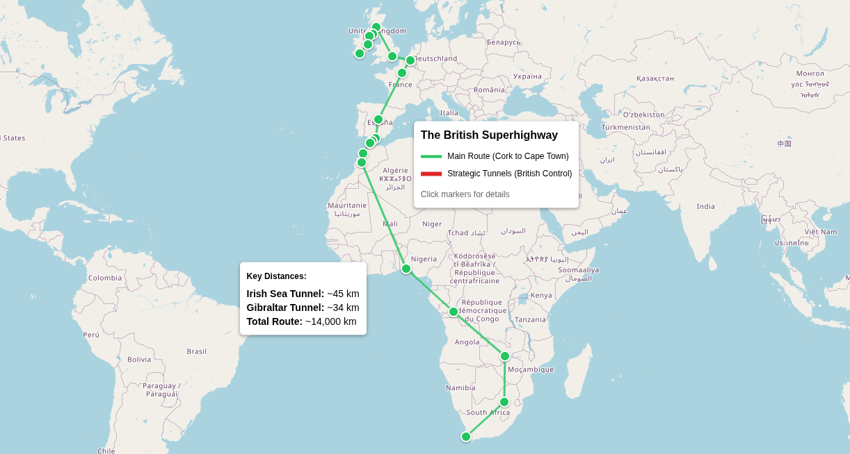
The opportunity is nevertheless real whichever way it goes. Morocco has repeatedly described the tunnel as strategic for Africa–EU trade. Spain views it as a catalyst for Andalusia's ports. Britain should invest in connecting infrastructure between the Rock and the Spanish AVE high-speed network, positioning Gibraltar as a rail-connected, deep-water, mid-strait logistics hub rather than an isolated peninsula accessible only by a single road and a short runway. The quid pro quo for Spain would be reduced friction at the border and increased trade through an even-further-contested outpost they already want. The quid pro quo for Morocco would be British project finance, insurance, and engineering participation towards a British free port. The quid pro quo for Britain would be a permanent position on what could become the most important infrastructure crossing of the mid-twenty-first century.
Treaty Obstacles
The Antarctic Treaty System constrains activity at Port Foster. As noted, logistics and SAR infrastructure are permissible. Military activity is not. The proposal stays within these bounds. Britain's claim to the British Antarctic Territory predates the Treaty and is maintained by successive governments. Establishing a seasonal facility does not violate the Treaty; it reinforces the claim.
Or we simply leave it.
- The Madrid Protocol does not expire in 2048. Any Consultative Party may call a review conference under Article 25.
- Under the United Nations Vienna Convention on the Law of Treaties (VCLT), where no withdrawal clause exists, withdrawal may still arguably occur if:
- parties intended withdrawal possibility; or
- a right of denunciation can be implied from the nature of the treaty.
The UN Convention on the Law of the Sea governs maritime zones around the Falklands, South Georgia, and Ascension. Britain has declared exclusive economic zones around all three. Argentina disputes the Falklands EEZ. The proposal does not require any change in the UNCLOS position; it simply invests in the infrastructure needed to administer and patrol zones Britain already claims.
There are no treaty obstacles to any of the remaining nine locations.
Workforce and Operations
Construction across the network would conservatively generate an estimated 5,000–8,000 direct jobs over a five-to-seven-year build programme, the majority in British construction, engineering, and maritime firms. Operational staffing thereafter would be smaller (perhaps 1,500–2,500 permanent positions across the network) but distributed across every territory, generating local employment, training pipelines, and economic activity in places currently dependent on subsistence, fishing, or government payroll.
For the Overseas Territories, the staffing model should draw on Saint Helenian and Falkland Islander populations, both of which have chronic labour shortages and ageing demographics, supplemented by contract workers from the UK. For the Commonwealth partners, the model should prioritise local hiring and training, with British personnel limited to technical and management roles during the construction phase.
A shared maritime training college based in Guyana with satellite facilities in Belize and the Falklands would produce the navigators, engineers, port operators, and SAR personnel the network needs. Cost: roughly £20–30 million to establish, £3–5 million per year to operate. Output: a pipeline of Commonwealth-trained maritime professionals with transferable qualifications recognised across the network.
Power and Water Targets
The network as a whole should aim for the following minimum capacities at full build-out:
| Location | Power Target | Water Target |
|---|---|---|
| Ascension | 20 MW (10 MW solar/battery + 10 MW SMR, replacing diesel entirely) | 250,000 gpd (desalination, nuclear-powered) |
| Saint Helena | 5 MW (solar + wind + battery) | Existing + 50,000 gpd supplement |
| Falklands (Mount Pleasant) | 25 MW (6.6 MW existing diesel + 6.9 MW wind + 10 MW SMR) | Existing catchment (adequate) |
| Cumberland Bay, S. Georgia | 2 MW (1–2 MW microreactor, eliminating diesel dependency) | 20,000 gpd (nuclear-powered RO) |
| Port Foster | 1 MW (containerised microreactor, seasonal deployment) | 5,000 gpd (nuclear-powered RO, seasonal) |
| Leguan Island, Guyana | 50 MW (gas turbine short-term; 50 MW SMR long-term) | 500,000 gpd (river treatment) |
| Big Creek, Belize | 5 MW (solar + diesel backup) | Rainwater + 50,000 gpd treatment |
| Walvis Bay, Namibia | Co-invest in Hyphen grid connection + 50 MW SMR for port/desalination | 2,000,000 gpd (nuclear-powered RO) |
| Bermuda | Existing grid + 5 MW wind/solar supplement | Existing supply (adequate) |
| Resolute Bay | 5 MW (microreactor, year-round, eliminating Arctic diesel dependency) | Existing local supply |
| Gibraltar | Existing grid | Existing supply |
Total network desalination capacity at full build-out: approximately 2.9 million gallons per day; or enough to supply water to every territory and facility in the system with surplus for local populations.
Search and Rescue Coverage
The current SAR picture in the South Atlantic is bleak, but Britannia rules it. The Falklands maintain a limited helicopter SAR capability. Ascension has minimal capacity. South Georgia has none. The nearest substantial SAR coordination centre to any of these territories is in Montevideo or Cape Town, both thousands of miles away and neither under British control. For now.
The network would establish SAR stations or expand existing capability at seven locations: Bermuda, Big Creek, Leguan Island, Ascension, Walvis Bay, Port William, and Cumberland Bay. Combined with patrol vessel deployments and helicopter-refuelling capability, this would provide continuous coverage across the western Atlantic, Caribbean, central Atlantic, south-eastern Atlantic, and Southern Ocean; an area currently served by almost nothing under British or Commonwealth coordination.
Target response radius per station: 500 nautical miles for surface vessels, 250 nautical miles for helicopter operations, with inter-station relay allowing network-wide coordination within 24 hours.
Every Location Reachable: Port, Airfield, Fibre
A network whose locations cannot all be reached by both sea and air is not a network. It is a collection of places. The current infrastructure fails this test: Ascension has no harbour; ships anchor offshore and lighter cargo by boat. Cumberland Bay has no airstrip. Port Foster has neither. Saint Helena's wharf handles only small vessels. Several locations lack submarine cable connectivity entirely.
At full build-out, every location in the network has three things:
- A berth or anchorage capable of receiving supply vessels;
- An airfield or helicopter facility capable of receiving transport aircraft or rotary-wing logistics, and
- A fibre-optic or high-bandwidth satellite data connection to the rest of the network.
The two locations where fixed-wing runways are impractical for now, Cumberland Bay (mountainous terrain, glaciers) and Port Foster (volcanic caldera, seasonal access), receive hardened helicopter pads and ship-based logistics instead. Every other location gets a paved runway of at least 5,000 feet, sufficient for C-130 Hercules and A400M Atlas operations. Until we fix the problem and start drilling into the landscape properly, as the British tend to specialise in the impossible. If necessary, we'll build one in the water or simulate an aircraft carrier.
The total cost of closing these gaps (channel deepening at Big Creek, a new quay at Leguan, a floating jetty at Cumberland Bay, mooring infrastructure at Port Foster, airstrip construction at Big Creek and Leguan, wharf extension at Saint Helena, cable spurs to the Falklands and Belize) is included in the individual location budgets.
The point is worth stating explicitly: at half the cost of HS2, every location is reachable by sea, by air, and by fibre. The remaining budget headroom (north of £45 billion) is not a maths error. It is the margin for expansion, operational funding, and the economic programme.
Atlantic Enterprise Zones
Infrastructure alone does not generate returns. Ports, airfields, cables, and power plants are the foundation. The revenue layer is commercial and the model already exists.
Cayman Enterprise City, established in 2011, operates as a special economic zone on Grand Cayman. By 2024 it hosted over 450 companies predominantly in technology, commodities, and maritime services generating $136 million in direct annual economic impact.
Chris Woodhouse, Esq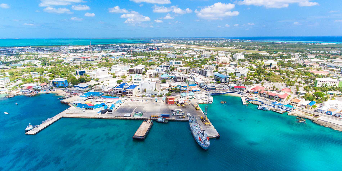
The structure is simple:
- 100 per cent foreign ownership permitted;
- Zero corporate tax;
- Zero income tax;
- Zero sales tax;
- Zero capital gains tax;
- Zero import duties on equipment;
- Five-year renewable work and residency visas processed in five business days;
- Intellectual property protections under Cayman law, and
- Plug-and-play serviced office space with high-bandwidth connectivity.
The Cayman model works because it combines tax neutrality with physical presence, legal stability, fibre connectivity, and reachability. A jurisdiction you can actually get to, with an airport, a port, and a data connection.
Every location in the Atlantic network meets or can be made to meet these conditions. The proposal establishes an Atlantic Enterprise Zone regime as a single legislative framework, enacted by Order in Council for the Overseas Territories and by bilateral agreement for the Commonwealth partners, providing the following at every location:
| Concession | Detail |
|---|---|
| Corporate tax | 0% on zone-registered enterprises |
| Income tax | 0% on zone employees (for Overseas Territories; negotiated locally for Commonwealth partners) |
| Import duty | 0% on equipment, materials, and supplies for zone enterprises |
| Capital gains | 0% |
| Foreign ownership | 100% permitted |
| Work permits | Fast-tracked, renewable five-year visas for zone employees and dependants |
| IP protection | Registered and enforceable under English common law |
| Data connectivity | Guaranteed minimum bandwidth via submarine cable or satellite backhaul |
| Reachability | Scheduled or charter air service; port access for cargo and personnel |
| Dispute resolution | English law, with arbitration under London Court of International Arbitration |
The sectors each zone targets would vary by location, playing to the geography:
| Location | Zone Specialism |
|---|---|
| Gibraltar | Maritime law, insurance, fintech, Europe–Africa trade services |
| Bermuda | Reinsurance (existing), maritime technology, hurricane resilience R&D |
| Big Creek, Belize | Tropical agriculture technology, reef science, Caribbean maritime services |
| Leguan Island, Guyana | Oil and gas services, offshore engineering, freshwater technology |
| Ascension Island | Satellite ground station operations, space logistics, cable maintenance |
| Saint Helena | Satellite downlink hosting, data processing, remote operations management |
| Walvis Bay, Namibia | Green hydrogen, mineral processing, maritime logistics, desalination technology |
| Port William, Falklands | Fisheries technology, cold-water marine biology, Antarctic logistics services |
| Cumberland Bay, S. Georgia | Antarctic research services, expedition logistics |
| Port Foster, BAT | Antarctic survey and mineral licensing administration (when framework permits) |
| Resolute Bay | Arctic shipping services, ice navigation, polar logistics, cold-weather testing |
The revenue model is self-reinforcing. Zone enterprises pay no tax, but they pay lease fees for serviced space, bandwidth fees for data connectivity, port fees for cargo, landing fees for aircraft, and utility charges for power and water; all of which flow to the facility operator and the host territory. The Cayman model generates $136 million per year from 450 companies on a 53-acre campus. An eleven-location network with submarine cable connectivity, deep-water ports, airfields, nuclear-powered electricity, and desalinated water offers a far larger platform.
The critical advantage over landlocked enterprise zones (the kind governments periodically announce for depressed northern towns) is jurisdictional. The Overseas Territories operate under English common law but outside the UK tax regime. They can offer genuine tax neutrality without violating OECD substance requirements, because the enterprises are physically present, employing people, occupying space, and conducting real operations in the zone. This is not brass-plating. It is the Cayman model applied to eleven locations with strategic infrastructure the Caymans lack: deep-water ports, military-grade airfields, satellite ground stations, and nuclear power.
The fibre connectivity is what makes the zones viable for knowledge-intensive industries. A technology company registered in the Saint Helena Enterprise Zone, operating from serviced office space with 131-millisecond latency to London via the Equiano cable, has access to English common law IP protection, zero corporate tax, and a satellite ground station campus on its doorstep. A maritime services firm registered in the Walvis Bay zone has access to the largest deep-water port in Atlantic Africa, a hydrogen fuel supply, and a direct fibre connection to Europe. An Arctic logistics company at Resolute has access to the Northwest Passage chokepoint, a microreactor-powered facility operating year-round, and satellite data downlink from polar orbits.
The zones do not replace the strategic and military value of the network. They fund it. Each enterprise zone generates the operating revenue to sustain the port, airfield, power, water, and communications infrastructure at its location; reducing and eventually eliminating the need for ongoing Treasury subsidy. The network becomes self-financing through commercial activity conducted on British sovereign territory or Commonwealth partner soil, under English law, connected by British-laid fibre, powered by British-built reactors, and reachable by sea and air from anywhere on earth.
What Can Berth Where
The point of building ports is to receive ships. Not every berth in the network needs to handle a supertanker. But every berth needs to accommodate the vessels the network actually operates: Royal Fleet, offshore patrol vessels, frigates, and the commercial cargo vessels servicing each territory. The following table shows what each location can handle at full build-out, measured by draft (the depth of water a vessel needs beneath its keel) and quay length.
For reference, a Type 26 frigate draws approximately 7.5 metres and is 150 metres long. A Type 31 frigate draws roughly 4.7 metres and is 138 metres long. A Tide-class tanker draws 10 metres and is 201 metres long. A Panamax container ship draws 12–13 metres and is 290 metres long.
| Location | Berth Draft (m) | Quay Length (m) | Can Accommodate |
|---|---|---|---|
| Gibraltar | 10+ (existing) | Multiple berths (existing) | Frigates, destroyers, RFA tankers, submarines, Panamax cargo |
| Bermuda (Dockyard) | 10+ (existing) | 300+ (existing, two wharves) | Frigates, RFA tankers, cruise ships to 340m LOA |
| Big Creek, Belize | 12 (post-deepening) | 618 (existing) + 300 (new berth) | Frigates, OPVs, medium cargo, oil tankers |
| Leguan Island, Guyana | 14 (new build) | 400 (new build) | Frigates, RFA tankers, Panamax cargo, FPSO shuttle tankers |
| Ascension Island | 6 (post-pier extension; currently offshore anchorage only) | 100 (new Georgetown pier extension) | OPVs, small cargo, patrol vessels alongside; larger ships at anchor with lightering |
| Saint Helena (Rupert's Bay) | 8 (post-upgrade) | 200 (post-upgrade) | OPVs, small cargo, fishing vessels, research ships |
| Walvis Bay, Namibia | 14+ (existing + North Port) | 600+ (existing) + 1,330 ha expansion | Frigates, RFA tankers, Panamax+ cargo, bulk carriers, VLCCs |
| Port William, Falklands | 10 (new jetty) | 250 (new build) | Frigates, RFA tankers, fishing fleet, cruise tenders |
| Cumberland Bay, S. Georgia | 15+ (natural depth) | 80 (floating pontoon) | Frigates, OPVs, research ships (natural anchorage in 100m+ water) |
| Port Foster, Deception Island | 20+ (caldera floor) | Mooring buoys only | Ships anchor inside caldera; no alongside facility |
| Resolute Bay | 8 (seasonal; ice-dependent) | 100 (new build, seasonal) | OPVs, ice-capable patrol ships, Arctic cargo, coast guard cutters |
The critical gap in the current British South Atlantic infrastructure is the absence of any berth between Ascension (no harbour at all; ships anchor offshore and lighter cargo by boat) and Stanley (limited alongside capacity in Stanley Harbour; Port William has deep water but no jetty). A vessel needing hull repair, propeller work, or underwater maintenance anywhere in the central or South Atlantic currently has no option closer than Cape Town, Simonstown, or a return to the UK. The proposed jetty at Cumberland Bay and the expanded quay at Port William close this gap. A frigate damaged in the Drake Passage could limp 800 miles to South Georgia for a welcoming cup of tea and BBC Two on YouTube rather than 4,000 miles to Cape Town.
What Can Land Where
The same logic applies to airfields. The network's value depends on what aircraft can reach what locations, and what those aircraft carry. The following table shows runway length, surface type, and the aircraft each location can handle at full build-out.
- A C-17 Globemaster III (the RAF's strategic airlifter, capable of carrying 77 tonnes of cargo including armoured vehicles, helicopters, and palletised supplies) needs a minimum of 3,500 feet of runway and can operate from unpaved surfaces. Its unrefuelled range is 4,700 nautical miles; with air-to-air refuelling it is unlimited.
- An A400M Atlas (the RAF's tactical transport) needs roughly 3,000 feet and carries 37 tonnes over 2,000 nautical miles.
- An Airbus A330 Voyager (the RAF's tanker/transport) needs 8,000+ feet and carries 45 tonnes of fuel or 291 passengers over 8,000 nautical miles.
- A C-130J Hercules needs 3,000 feet and carries 20 tonnes over 2,000 nautical miles.
- A Merlin helicopter has a combat radius of roughly 300 nautical miles.
- A Chinook reaches roughly 200 nautical miles with a full load.
| Location | Runway / Pad | Length | Surface | Handles |
|---|---|---|---|---|
| Gibraltar (RAF) | Runway 09/27 | 6,000 ft | Paved | A400M, C-130, Typhoon fighters, Voyager (tight but operational), civilian jets |
| Bermuda (L.F. Wade) | Runway 12/30 | 9,713 ft | Paved | C-17, Voyager, A400M, wide-body civilian, P-8 Poseidon MPA |
| Big Creek, Belize | New strip (proposed) | 5,000 ft | Paved/gravel | C-130, A400M, medium transport, light civilian; helicopter pad |
| Leguan Island, Guyana | New strip (proposed) | 6,000 ft | Paved | C-130, A400M, C-17 (light load); helicopter pad |
| Ascension (Wideawake) | Runway 13/31 | 10,000 ft | Paved (rebuilt 2023) | C-17, Voyager, A400M, wide-body civilian, P-8 Poseidon, Typhoon (with tanker support) |
| Saint Helena | Runway 02/20 | 6,200 ft | Paved | C-130, A400M (light load), Embraer E190, regional jets; helicopter pad |
| Walvis Bay | Runway 08/26 | 7,000 ft | Paved | C-130, A400M, C-17 (light load), medium civilian jets |
| Mount Pleasant, Falklands | Runway 10/28 | 8,500 ft | Paved | C-17, Voyager, A400M, Typhoon, P-8 Poseidon, wide-body civilian |
| Cumberland Bay, S. Georgia | Helicopter pad only | N/A | N/A | Merlin, Chinook, Wildcat; no fixed-wing capability |
| Port Foster, Deception Island | None | N/A | N/A | Ship-borne helicopter operations only |
| Resolute Bay | Runway 17T/35T | 6,500 ft | Gravel | C-130, C-17 (light load), Twin Otter, A400M; helicopter pad |
The strategic airfield picture is this: the RAF currently has exactly two runways in the South Atlantic capable of handling its full range of transport and combat aircraft: Ascension and Mount Pleasant. If either becomes unusable (volcanic activity on Ascension; damage or weather at Mount Pleasant), the entire air bridge collapses. The proposed expansions at Big Creek, Leguan, and Saint Helena do not replicate this heavy-lift capability, but they provide intermediate staging points for A400M and C-130 operations, dramatically increasing the flexibility and resilience of the air logistics chain.
- A C-17 loaded at Brize Norton can reach Ascension (4,280 miles) in one hop without refuelling.
- From Ascension, a second C-17 or A400M sortie can reach Mount Pleasant (3,800 miles).
- In an emergency, the C-17 can stage through Bermuda (3,450 miles from Brize Norton) or Leguan (4,570 miles with tanker support) as alternatives.
The point is redundancy. In 1982, the entire Falklands air bridge depended on a single island with a single runway. The network provides four alternative staging airfields between the UK and the South Atlantic.
The Network Changes Crisis Response
In April 1982, the Royal Navy assembled a task force of 127 ships, sailed 8,000 miles, and fought a war to recover two islands most Britons had never heard of. The operation succeeded, but it depended on a chain of single points of failure: Ascension Island for air staging, a single aircraft carrier (Hermes) and a single light carrier (Invincible) for air cover, no intermediate repair or resupply facility between Ascension and the Falklands, and a logistics tail stretching back to the UK through waters patrolled by Argentine submarines.
The network described in this article would transform the operational picture. Consider three scenarios.
A South Atlantic crisis (Falklands-type contingency)
In 1982, the Task Force sailed from Portsmouth to Ascension (3,700 nautical miles), paused to reorganise, then sailed from Ascension to the Falklands operational area (another 3,400 nautical miles). There was no repair facility, no fuel depot, and no sheltered anchorage between Ascension and the war zone. Damaged ships either continued fighting or withdrew 3,400 miles to Ascension. HMS Sheffield was hit 200 miles east of the Falklands. There was nowhere closer than 3,400 miles to attempt a repair.
With the network, the picture changes:
- Bermuda provides a western Atlantic assembly and repair point for ships crossing from the UK or reinforcing from North America.
- Ascension remains the mid-Atlantic air bridge, but with hardened fuel storage, nuclear and solar power reducing diesel dependence, expanded accommodation for surge personnel, and upgraded SAR capability.
- Walvis Bay provides an alternative southern staging area on the African side of the Atlantic, 3,400 nautical miles from the Falklands but reachable from the UK via a completely different route, avoiding the mid-Atlantic corridor entirely.
- Port William receives supply ships directly alongside a deep-water jetty rather than requiring lightering in exposed anchorage.
- Cumberland Bay provides emergency repair, refuelling, and medical capability 800 miles south-east of Stanley, within helicopter range of the Drake Passage and the Antarctic Peninsula.
The single-thread logistics chain becomes a web. An adversary would need to interdict not one route but five. A damaged ship has not one refuge but four. An air sortie has not one staging airfield but six between Brize Norton and Mount Pleasant.
A West African humanitarian emergency
In 2014, the UK deployed RFA Argus and a company of Royal Marines to Sierra Leone during the Ebola crisis. The deployment depended entirely on overflight permissions from transit countries and port access in Freetown. There was no British-controlled staging facility anywhere on the West African coast.
With the network:
- Ascension provides an air staging point 1,000 miles offshore from the Gulf of Guinea.
- Walvis Bay (2,500 nautical miles south of the Gulf of Guinea) provides deep-water bunkering, supply loading, and a repair berth without dependence on any West African government's cooperation.
- A Voyager tanker flying from Brize Norton to Ascension (4,280 miles) can refuel at Wideawake and support air operations across the entire Gulf of Guinea from there.
- C-17 flights from Ascension can reach any West African coastal capital within five hours.
- Royal Navy ships pre-positioned at Walvis Bay can sail north and arrive off Freetown, Accra, or Lagos in four to six days.
The difference between the Ebola deployment and a future humanitarian operation is not the number of ships or aircraft. It is the availability of secure, British-controlled fuel, repair, and staging infrastructure within operational range. The 2014 deployment worked because Sierra Leone cooperated.
The next crisis may occur in a country whose government has collapsed, denied overflight, or signed up with a hostile power. The network provides the option of operating from sovereign or partnership-secured territory rather than relying on the goodwill of the crisis state.
Arctic contingency
NATO's Allied Maritime Command at Northwood is responsible for the Atlantic from the Arctic to the Antarctic. The alliance's ability to monitor and if necessary control the Northwest Passage, the Greenland–Iceland–UK gap, and the Arctic approaches to North America depends on forward-deployed surveillance, SAR, and patrol capability.
Resolute Bay sits at the junction of the Northwest Passage routes. A joint UK–Canadian facility there (harbour, fuel depot, nuclear, satellite ground station, ice-capable patrol vessels) extends NATO's Arctic domain awareness 1,500 miles further north and west than any current allied facility.
- The Royal Navy's HMS Protector already operates in polar waters. We can build plenty more.
- Type 26 frigates, with a 7,000-nautical-mile range on electric or nuclear drive, could deploy from the UK to Resolute Bay (3,150 miles) without refuelling, patrol the passage routes, and return.
- Or continue south through the Canadian Arctic to Bermuda (3,500 miles from Resolute) for resupply.
The Arctic scenario is not speculative. Russia has reopened Soviet-era bases across its northern coast. China declared itself a "near-Arctic state" in 2018 and has sought observer status on the Arctic Council. As summer ice retreats, the Northwest Passage will become navigable for commercial and military vessels for increasingly long seasons. The question is not whether the passage will be used, but who monitors and manages the traffic. Resolute, jointly held, jointly funded, jointly operated, answers the question for the allied side. We will.
The Longer Game: Antarctica, Space, and What Comes After Oil
Everything described so far operates within the current international order. Ports, airfields, cables, patrol routes; all of these function under existing treaties and established law. But the network also positions Britain for three developments the current order has not yet resolved: the future of Antarctic resources, the commercialisation of deep space logistics, and the global surveillance architecture of the satellite age.
The 2048 Question
The Protocol on Environmental Protection to the Antarctic Treaty, signed in Madrid in 1991, in force since 1998, prohibits all activity relating to mineral resources in Antarctica except scientific research. What happens in 2048 is simpler and more consequential: any Consultative Party may request a review conference. After the review, amendments could be adopted by three-quarters of the Consultative Parties, but would only enter into force if ratified by all 26 original signatories: including Britain, which holds the largest territorial claim on the continent.
The mining ban is therefore durable but not permanent. Its continuation depends on sustained political consensus among the Consultative Parties. If, at any point after 2048, a binding legal framework for mineral resource activity were established (which would itself require consensus) the ban could be modified.
Britain's claim to the British Antarctic Territory covers 660,000 square miles of the continent, overlapping with claims by Argentina and Chile. The territory has been identified in geological surveys as potentially containing significant hydrocarbon and mineral resources, though the Protocol has prevented any exploration beyond scientific sampling. The seabed around the Antarctic Peninsula, accessible from Port Foster and Cumberland Bay, includes some of the least-explored continental shelf on earth. Which means, for the Englishman.......... adventure.
Alex Coppen
China has built five research stations in Antarctica, more than any country except the United States and Russia. Chinese geological surveys in the territory have been extensive. Russia has expanded its own station network. In 2023, the Antarctic Treaty Consultative Meeting passed a resolution reaffirming the mining ban, partly in response to growing concern about where Chinese and Russian activity is heading. The resolution was reassurance, not resolution. The geological surveys continue.
The British position should be straightforward.
- The 660,000 square miles of territory Britain claims contain mineral and hydrocarbon resources whose extent is unknown because the Protocol has prevented systematic exploration.
- At some point (whether in 2048 or later) the question of responsible extraction under a binding regulatory framework will arise, because the resources are there and because other Consultative Parties with less interest in environmental standards will push for access.
- When it does, Britain should be in the room with a credible claim, physical presence, functioning infrastructure, and a regulatory proposal. Not watching from London while China and Russia negotiate the terms.
A facility at Port Foster and an anchorage at Cumberland Bay are not gestures. They are the prerequisites for any future licensing, inspection, or regulatory regime in the British Antarctic Territory. They are also the prerequisites for leasing any form of access to the territory: for scientific research, for offshore survey, for deep-sea mineral sampling, or eventually for extraction under whatever framework emerges.
Physical presence has weight in international law. It is the reason Argentina and Chile maintain their own stations on Deception Island. It is the reason China builds stations. Without presence, a territorial claim erodes into paper. With presence, it remains a position; and a revenue-generating one.
Nuclear and Deep Space
Nuclear power is not optional for this network. It is the enabling technology.
Solar and wind work well at equatorial and mid-latitude locations, i.e. Ascension, Saint Helena, Guyana, Namibia, Belize. They do not work at 54°S (South Georgia, where winter daylight lasts six hours and wind loads destroy lightweight turbines) or 74°N (Resolute Bay, where the sun does not rise for months). Diesel is the current default at every remote British territory, and it is expensive, logistically fragile, and dependent on supply ships running on schedule. A single missed fuel delivery to Ascension grounds the air bridge. A storm delaying the Falklands resupply tanker puts Stanley's power station on rationing.
Small modular reactors (factory-built nuclear units generating up to 300 MW of electricity, transportable by ship, deployable in 2–3 years) solve the problem. The US Army operated portable reactors at remote sites for six years in the 1960s, including a 10 MW unit at Camp Century under the Greenland ice sheet. The technology is not new. What is new is the commercial pipeline: Microreactors of 1–20 MW, small enough to fit in a shipping container, are under development with DOE backing, targeted at remote military installations and off-grid communities.
The network should deploy nuclear at three tiers:
| Tier | Capacity | Technology | Locations | Purpose |
|---|---|---|---|---|
| Microreactor | 1–5 MW | Containerised, passively safe, factory-sealed fuel | Resolute Bay, Cumberland Bay, Port Foster (seasonal) | Year-round base power; eliminates diesel dependency at extreme latitudes |
| Small modular | 10–50 MW | NuScale, Rolls-Royce SMR, or equivalent | Ascension Island, Falklands (Mount Pleasant) | Replace diesel primary generation; power desalination; support surge operations |
| Grid-connected SMR | 50–300 MW | Rolls-Royce SMR or equivalent | Walvis Bay (co-investment with Namibia), Leguan Island (co-investment with Guyana) | Power industrial-scale desalination, hydrogen electrolysis, port operations |
The connection between nuclear power and deep space is direct. NASA's nuclear thermal propulsion programme (the DRACO project with DARPA) aims for an in-space demonstration by the late 2020s. Nuclear thermal propulsion could cut Mars transit times from seven months to roughly three, reducing crew radiation exposure and mission risk dramatically. But nuclear propulsion systems require testing, assembly, and staging infrastructure in environments far from populated areas, and under jurisdictions willing to handle the regulatory, safety, and political complexity of nuclear technology in space.
The British Antarctic Territory is the most remote landmass on earth under a single sovereign claim. Port Foster's caldera provides natural containment. The surrounding ocean is thousands of miles from any population centre. If nuclear-powered spacecraft components ever require assembly, testing, or staging in a location combining remoteness, shelter, deep water for ship access, and a sovereign jurisdiction with mature nuclear regulatory capability, the British Antarctic Territory is one of a very small number of candidates. The only one under British sovereignty.
The United States has a concrete interest in allied sovereign territory capable of supporting nuclear space logistics. Britain has a concrete interest in being the ally who can provide it.
The British network supplies the chain: fuel from Walvis Bay or Guyana, air staging through Ascension, cargo relay through the Falklands, and final delivery to Cumberland Bay or Port Foster, needed to sustain nuclear operations at the bottom of the world. The microreactors at Cumberland Bay and Port Foster would themselves demonstrate exactly the kind of remote nuclear deployment the space programme requires.
Eyes and Ears: The Surveillance Picture
Ascension Island already hosts a US GPS monitor station; one of only six original stations worldwide, and the only one in the South Atlantic. The station tracks up to eleven satellites simultaneously, feeding orbital and clock corrections to the GPS Master Control Station at Schriever Air Force Base in Colorado. Without Ascension, GPS accuracy degrades across the entire South Atlantic, the Gulf of Guinea, and the eastern coast of South America.
The network would create a chain of satellite ground stations stretching from 74°N (Resolute Bay) to 63°S (Port Foster), covering virtually every orbital inclination used by military, intelligence, and commercial satellite constellations. The specific capability at each location:
| Location | Latitude | Ground Station Function |
|---|---|---|
| Resolute Bay | 74°N | Polar orbit downlink; Arctic surveillance; NORAD data feed |
| Bermuda | 32°N | Mid-latitude tracking; GPS augmentation; hurricane surveillance |
| Big Creek, Belize | 16°N | Tropical orbit tracking; Caribbean maritime surveillance |
| Leguan Island, Guyana | 7°N | Near-equatorial downlink; South American coverage |
| Ascension Island | 8°S | GPS monitor station (existing); equatorial tracking; SIGINT relay |
| Saint Helena | 16°S | Polar orbit downlink (OneWeb ground station operational); data backhaul via Equiano cable |
| Walvis Bay, Namibia | 23°S | Southern hemisphere tracking; African coastal surveillance |
| Port William, Falklands | 52°S | Sub-Antarctic orbit tracking; Southern Ocean surveillance |
| Cumberland Bay, S. Georgia | 54°S | High-latitude polar orbit downlink |
| Port Foster, BAT | 63°S | Antarctic orbit downlink; deep-south coverage gap elimination |
No other country or alliance has ground station coverage spanning this range of latitudes in the Atlantic basin. The United States comes closest, but relies on Ascension (British territory) and Argentina (which hosts a GPS monitor station, but whose political reliability varies by administration). China has been building ground stations in Antarctica and across Africa but has no Atlantic island chain equivalent.
A polar-orbiting satellite (the type used for earth observation, weather, signals intelligence, and some communications constellations) passes over every point on earth roughly twice per day, but can only downlink data when within line-of-sight of a ground station. The gaps between ground stations determine how long data sits in onboard storage before transmission, and therefore how old the intelligence is when it reaches an analyst. A ground station at Saint Helena, for example, can receive data from a polar-orbiting satellite passing over West Africa, the Gulf of Guinea, or the central Atlantic within minutes of acquisition. Without Saint Helena, the same satellite stores its data until it reaches a ground station in Europe or North America; a delay of potentially several hours and several orbits.
The Equiano cable, already landing at Saint Helena, Namibia, and Portugal, provides the fibre-optic backhaul needed to move ground station data to European processing centres at the speed of light. The network's cable infrastructure is therefore not separate from its surveillance function. It is the same infrastructure.
For the Five Eyes intelligence partnership, the Atlantic network fills a gap no other allied territory can.
- Pine Gap covers the Indo-Pacific from central Australia.
- Menwith Hill covers the North Atlantic and Europe from Yorkshire.
- GCHQ Bude covers transatlantic cable traffic from Cornwall.
The South Atlantic, one of the most important maritime corridors on earth, carrying oil from West Africa and the Gulf, minerals from southern Africa, and increasingly LNG from Guyana, has no equivalent ground station chain under allied sovereignty. The network creates one.
Commercial Space Logistics
The satellite ground station chain has a commercial dimension separate from its intelligence value. Low Earth orbit constellations (e.g. OneWeb, which is partly British-owned, SpaceX's Starlink, Amazon's Kuiper/Leo) require ground stations distributed across latitudes to maintain continuous contact with their satellites. OneWeb has already signed a ten-year agreement for a ground station on Saint Helena. The commercial demand for ground station sites in the South Atlantic will grow as these constellations expand.
Each ground station in the network could host commercial operators alongside government and military users, generating rental income, data transit fees, and local employment. The investment in power, cable, and communications infrastructure described earlier for each location creates the conditions commercial operators need: reliable electricity, high-bandwidth fibre backhaul, physical security, and stable governance.
A single prepared ground station site on Saint Helena or Ascension could host three to five commercial operators paying annual lease and bandwidth fees sufficient to cover the operating costs of the entire local facility.
SpaceX's Starship, capable of lifting 200 tonnes to low Earth orbit, changes the calculus of what can be placed in orbit and how it is serviced. But every payload launched still requires ground infrastructure for tracking, telemetry, command, and data downlink. The more tonnage in orbit, the more ground stations are needed. The Atlantic network positions Britain not as a launch provider (it does not yet compete with Cape Canaveral, Kourou, or Baikonur, but that's stage two) but as the Atlantic ground infrastructure partner for every launch provider. Launch is American. Ground support, across a 12,000-mile chain of sovereign territory from the Arctic to the Antarctic, could be British.
Wasteful Technocrats Vs Systems Thinking
A railway connects two cities. A network connects an ocean. A railway serves passengers travelling between London and Birmingham, which is a journey currently possible by existing rail in one hour and twenty minutes. A network serves trade routes, energy flows, data connections, fisheries, mineral supply chains, scientific research, military logistics, search-and-rescue coverage, and diplomatic relationships across a quarter of the earth's surface.
A railway has a single point of failure: if the track is blocked, nothing moves. A network has redundancy: if one location is disrupted, traffic re-routes through others.
A railway depreciates. Track degrades, signalling ages, rolling stock wears out. A network appreciates. Each new connection increases the value of every existing location. Each new investment in one place reduces the cost of operating in every other.
Britain is spending a hundred billion pounds on the first kind of thinking.
The Atlantic is waiting for the second.